
GeoSphere Austria · Quellen
Skitouren · Kanton Wallis
Agassizjoch · Traverse from Finsteraarhornhütte to Aarbiwak
Höhenprofil
Schneehöhe
Modell · 1 kmSchneemodell wird geladen …
- Strecke
- 14,6 km
- Aufstieg
- 1.500 m
- Abstieg laut Quelle
- 1.800 m
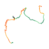
Skitour · Kanton Wallis. Die veröffentlichte Linie ist 14,6 km lang.
Kartenebenen
Tour mitnehmen
GPX herunterladen ↓Originale Routenlinie mit geschätzten Höhen aus unserem Höhenmodell. Ohne Anmeldung oder App nutzbar.
ODbL 1.0 + CC BY-SA 3.0 FR · Lizenz. Quellenangaben sind in der Datei enthalten.
- Höchster Punkt
- ≈ 3.919 m
Kurzbeschreibung laut Quelle
An elegant way to access the Aarbiwak form the Fiescher-area without doing the infinite approach from the Grimsel.
Wegbeschreibung laut Quelle
### Ascend the Agassizjoch
Follow the associated route respectively the swisstopo trace from the Finsteraarhornhut. While not necessary, it is recommended to continue and ski the beautiful Agassizhorn S-face (+200m).
### Descend the Agassizjoch E-Couloir
Do a 15m rappel, skis already attached, into the couloir from a well-equipped (2026) rappel point (see remarks below). Descend the steep couloir (tentative rating: 5.1/E3, top close to 50°, end towards 45°, rocks close by). Pay attention to the Bergschrund.
### Optional/Variant: Nass Strahlegg and its E-couloir
While not necessary, reascend the Nass Strahlegg, which gives an amazing overview of the area (+200m). In its E-face, there's also a couloir starting at P.3381 which gives faster access to the Aarbiwak (tentative rating (not skied): 4.3).
### Reach the Aarbiwak
Desend the crevassed Finsteraargletscher and from its bottom reascend the Aarbiwak according to the swisstopo trace.
Hinweise laut Quelle
### Agassizjoch E-Couloir
* The snow conditions might vary considerably. The associated pictures were made May 2026 after a rather dry winter/spring. In very good conditions, no rappel might be needed while in even worse conditions, more than 15m should be considered.
* The top-half of the couloir gets already completely dry in summer and thus does not change anymore, the bottom-half is still ice/firn and might as-well get closer to 50° and narrower over the next years.
* The couloir gets immediate morning sun. In warm spring conditions, a descend ca. 2h after sunrise should be envisaged.
* Pay attention to rockfall.
### Others
* The variant from Nass Strahlegg avoids the crevassed Finsteraargletscher but is also oriented E (timing!).
* If the moraine below the bivouac is already dry, it is easier to leave the skis directly there.
* The indicated data includes the ascent of Agassizhorn and Nass Strahlegg with descent via the Finsteraargletscher.
Die Karte zeigt die veröffentlichte Linie. Auf- und Abstieg aus der Quelle bleiben deren Originalangaben; Schätzungen entlang der Linie sind mit ≈ markiert. Ein zusätzlicher Rückweg ist nicht automatisch in der Linie enthalten. Höhenprofil aus Copernicus DEM, geschätzt. Anbieterwerte können davon abweichen.
Wetter · nächste 48 Stunden
Wetter wird geladen …
BULLETIN
Lawinenlage in den Tourenregionen
Berichtsregionen entlang der Linie: Schreckhorn, Konkordia Gebiet
Regionale Lawinenberichte bewerten keine einzelne Tour. Beachte Gültigkeit, Höhenlage und Exposition.
NATUR · NATURE
Unterwegs im Schutzgebiet
Im verfügbaren Datenbestand ist entlang der Linie kein Schutzgebiet gefunden. Lokale Hinweise bleiben maßgeblich.
Auf dem iPhone öffnen · QR
Quelle & Datenstand
Camptocamp · CaBot, flints7one · https://www.camptocamp.org/routes/1909100 · Coordinates reprojected; DEM elevation estimates · ODbL 1.0 + CC BY-SA 3.0 FR
Camptocamp · 2026-06-02T09:19:28.654786+00:00
Produced using Copernicus WorldDEM-30 © DLR e.V. 2010-2014 and © Airbus Defence and Space GmbH 2014-2018 provided under COPERNICUS by the European Union and ESA; all rights reserved.
Tour-ID: c2c:route/1909100 · Revision: 8b96e4b802ce