
GeoSphere Austria · Quellen
Höhenprofil
Schneehöhe
Modell · 1 kmSchneemodell wird geladen …
- Strecke
- 13,7 km
- Aufstieg
- 1.220 m
- Abstieg laut Quelle
- 1.220 m
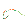
Skitour · Département Hautes-Alpes. Die veröffentlichte Linie ist 13,7 km lang.
Kartenebenen
Tour mitnehmen
GPX herunterladen ↓Originale Routenlinie mit geschätzten Höhen aus unserem Höhenmodell. Ohne Anmeldung oder App nutzbar.
ODbL 1.0 + CC BY-SA 3.0 FR · Lizenz. Quellenangaben sind in der Datei enthalten.
- Höchster Punkt
- ≈ 2.995 m
Wegbeschreibung laut Quelle
If the road is not open until Pré de Madame Carle, start by following it cutting across some bends until the meadow. Pass the Cézanne refuge, go up not far from the torrent of Glacier Noir if the snow cover is sufficient, if not on the right bank with slight overhanging wall (do not climb too high). These slopes on the right bank are very exposed to avalanches in the event of spells of milder weather or in the event of strong snowfalls, coming from the northern side of Bosse de la Momie. You reach the Glacier Noir, go up it to 2400 m. You will be in front of the junction of both branches of the glacier. Go up the S branch which leads to Col de la Temple passing the foot large N faces (Pelvoux, Pic Sans Nom, Ailefroide): a northern facing steep slope, to the east of a rocky Rognon, leads to the higher flat area around 2520 m.(route well marked on the IGN map). It takes 2 and a half hours from the entrance to Pré de Madame Carle. Then skirt a rock band and go towards the SE via a turning movement, leave the Glacier Noir around 2600 m., passing just to the N of the N part of the arm of the small glacier N of Pelvoux, which is no longer named on recent IGN maps. Climb a steep slope to the N of the ridge which descends to the SW of Bosse de la Momie, you emerge in a small less steep scoop and reach spot elevation 3054 m. (no longer on recent IGN editions) at the bottom of the scoop. The summit (3089 m) is reached on foot. It takes 2 and a half hours from the altitude of 2520 m., 4 and a half hours total. Descent: by the same route. Due to the orientation, the snow transforms rather late in the upper part. S3 section before returning to Glacier Noir. The snow remains good due to the correct conditions of frost in the low part of the glacier, under 2400 m. thanks to the shadow cast by the north face of the Bosse de la Momie. Be careful of the large avalanche corridors on the right bank when arriving above Cézanne.
Hinweise laut Quelle
The entire beginning of the route faces NE, then N, it starts to face SW around 2660 m.
Access:
L'Argentière la Bessée > Vallouise > Pelvoux > Ailefroide > Le pré de Madame Carle. Generally the road is open until the entry of Pré Madame Carle in spring, just before the place called "camp des militaires". The HD are indicated from this point. However, depending on the snow cover, the road may be closed at the Ailefroide exit (until around mid April, add an hour), or Claux à Pelvoux tunnel (until around the beginning of April, add two hours). For information call Pelvoux town hall at 04.92.23.31.07
Accommodation:
It is possible to spend the night at the Cézanne refuge (CAF) at Pré de Madame Carle (1874 m). The refuge is open but not attended in winter, basic comforts, a dozen places. It is the first small building to the right of Pré de Madame Carle chalet-refuge (private, not attended, not open in winter),
Ausrüstung laut Quelle
Normal crevassed glacier equipment, ice axe and crampons, stoves and bedding for the Cézanne refuge.
Wegbeschreibung laut Quelle
Se la strada non è aperta fino al Pré de Madame Carle, iniziare a seguire questa, tagliando alcune curve, fino al pré. Superare il rifugio Cézanne, risalire non lontano dal torrente del ghiacciaio Noir se l'innevamento è sufficiente, altrimenti dalla sponda destra leggermente inclinata (non salire troppo in alto). Questi pendii sulla sponda destra sono molto esposti alle valanghe in caso di disgelo o di forti nevicate, in provenienza dal versante nord della Bosse de la Momie. Raggiungere il glacier Noir, risalirlo fino a 2400 m. Ci si trova dinanzi alla biforcazione dei due rami del ghiacciaio. Risalire il ramo S che conduce al col de la Temple passando ai piedi delle grandi pareti N (Pelvoux, Pic Sans Nom, Ailefroide): un pendio molto ripido orientato a nord, ad est di un modulo roccioso, conduce sul ripiano superiore verso 2520 m.(itinerario ben segnato sulla cartina IGN). Considerare 2 ore e 30 dall'ingresso del pré de Madame Carle. Costeggiare una barra rocciosa quindi deviare a SE con un movimento rotatorio, lasciare il glacier Noir verso 2600 m., passare a N della parte N della lingua del piccolo ghiacciaio di Pelvoux, che non è più citato sulle recenti cartine IGN. Scalare un pendio molto ripido a N della cresta che scende a SW della Bosse de la Momie, arrivare ad una piccola conca meno ripida e raggiungere in fondo alla conca il punto quotato 3054 m; (che non è più non quotato sulle recenti edizioni IGN). La cima (3089 m) si raggiunge a piedi. 2.30 ore da quota 2520 m, 4.30 ore in tutto. Discesa: dallo stesso itinerario. Visto l'orientamento, la neve si scioglie abbastanza tardi nella parte superiore. Passaggio di S3 prima di ritrovare il glacier Noir. La neve rimane solida se ci sono buone condizioni di gelo nella parte bassa del ghiacciaio, sotto i 2400 m. grazie all'ombra che fa la parete nord della Bosse de la Momie. Fare attenzione ai canaloni di valanga sulla sponda destra arrivando sopra Cézanne.
Hinweise laut Quelle
Non è OSA come dichiarato sulla guida CDA ma al massimo BS
Tutto l'inizio dell'itinerario è orientato a NE, poi a N, l'orientamento diventa SW verso i 2660 m.
Accesso :
L'Argentière la Bessée > Vallouise > Pelvoux > Ailefroide > Il pré de Madame Carle. La strada è generalmente tracciata fino all'ingresso del pré de Madame Carle in primavera, poco prima del luogo chiamato campo dei soldati. I dislivelli sono indicati a partire da questo punto. Tuttavia, in funzione dell'innevamento, la strada può essere chiusa già all'uscita di Ailefroide (fino a metà aprile circa, aggiungere un'ora), o al tunnel dei Claux a Pelvoux (fino ad inizio aprile circa, aggiungere due ore). Informazioni presso il comune di Pelvoux al numero +33 (0)4.92.23.31.07
Alloggio :
È possibile trascorrere la notte al rifugio Cézanne (CAF) al Pré de Madame Carle (1874 m). Il rifugio è aperto anche in inverno ma non è custodito, confort spartano, circa dodici posti. È la prima piccola costruzione a destra dello chalet-rifugio del Pré de Madame Carle (privato, non custodito e non aperto in inverno).
Ausrüstung laut Quelle
Solita attrezzatura per ghiaccio crepacciato, piccozza e ramponi. Fornelli e coperte per il rifugio Cezanne.
Wegbeschreibung laut Quelle
[img=750712 right]La Bosse et la Brèche de la Momie[/img]
##Montée
Du Pré de Madame Carle, dépasser le refuge Cézanne et s’élever à proximité du torrent du glacier Noir si l’enneigement est suffisant - sinon utiliser les pentes déversantes en rive droite sans monter trop haut.
Atteindre le glacier Noir et le remonter jusqu’à 2400 m. Remonter sa branche S (qui mène au col de la Temple en passant au pied des grandes faces N des Pelvoux, Pic Sans Nom et Ailefroide). Une pente raide orientée N, à l’E d’un rognon, mène sur un plat vers 2520 m.
Longer alors une barre rocheuse, puis obliquer au SE par un mouvement tournant. Quitter le glacier Noir vers 2600 m, et passer à l'aplomb du petit glacier N du Pelvoux (qui n’est plus nommé sur les récentes cartes IGN). Gravir une pente raide le long de l’arête qui descend au SW de la Bosse de la Momie, déboucher dans une petite combe moins raide et atteindre le fond de celle-ci (3054 m). On peut rejoindre le sommet (3089 m) à pied.
##Descente
Par le même itinéraire.
Hinweise laut Quelle
- Tout le début de l'itinéraire est orienté NE, puis N. Les pentes deviennent SW à partir de 2700 m. Au printemps, la transformation de la neige est donc assez tardive.
- Se méfier des grands couloirs d’avalanche rive droite au-dessus du refuge Cézanne.
Die Karte zeigt die veröffentlichte Linie. Auf- und Abstieg aus der Quelle bleiben deren Originalangaben; Schätzungen entlang der Linie sind mit ≈ markiert. Ein zusätzlicher Rückweg ist nicht automatisch in der Linie enthalten. Höhenprofil aus Copernicus DEM, geschätzt. Anbieterwerte können davon abweichen.
Wetter · nächste 48 Stunden
Wetter wird geladen …
BULLETIN
Lawinenlage in den Tourenregionen
Für diese Linie ist hier keine EUREGIO-Berichtsregion hinterlegt.
Aktuelle Gefahr und Gültigkeit im amtlichen Bericht prüfen. Lawinenwarndienste
Regionale Lawinenberichte bewerten keine einzelne Tour. Beachte Gültigkeit, Höhenlage und Exposition.
NATUR · NATURE
Unterwegs im Schutzgebiet
Massif Du Pelvoux
Site classé selon la loi de 1930
Kartendarstellung vereinfacht; maßgeblich ist die verlinkte Originalquelle.
Ecrins
Parc national, zone cœur
Kartendarstellung vereinfacht; maßgeblich ist die verlinkte Originalquelle.
Auf dem iPhone öffnen · QR
Quelle & Datenstand
Camptocamp · Camptocamp-Association, Christian, Frédéric Bunoz, Cédric Colomban, Stephane Peiti, minilamb, Antoine Marnat, rabot, botopo, CaBot · https://www.camptocamp.org/routes/46088 · Coordinates reprojected; DEM elevation estimates · ODbL 1.0 + CC BY-SA 3.0 FR
Camptocamp · 2022-01-31T17:08:33.161879+00:00
Produced using Copernicus WorldDEM-30 © DLR e.V. 2010-2014 and © Airbus Defence and Space GmbH 2014-2018 provided under COPERNICUS by the European Union and ESA; all rights reserved.
Tour-ID: c2c:route/46088 · Revision: 4a9334528acb