
GeoSphere Austria · Quellen
Höhenprofil
Schneehöhe
Modell · 1 kmSchneemodell wird geladen …
- Strecke
- 4,9 km
- Aufstieg
- 1.121 m
- Abstieg laut Quelle
- 1.121 m
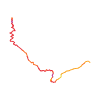
Skitour · Kanton Wallis. Die veröffentlichte Linie ist 4,9 km lang.
Kartenebenen
Tour mitnehmen
GPX herunterladen ↓Originale Routenlinie mit geschätzten Höhen aus unserem Höhenmodell. Ohne Anmeldung oder App nutzbar.
ODbL 1.0 + CC BY-SA 3.0 FR · Lizenz. Quellenangaben sind in der Datei enthalten.
- Höchster Punkt
- ≈ 2.451 m
Kurzbeschreibung laut Quelle
Shares the same start as for the Bel Oiseaux col.
Wegbeschreibung laut Quelle
##Ascent
[img=316724 right]Col de Fenestral - Blantsin - Itinéraire bleu descente par la face SE de l'antécime E[/img]
Above Finhaut the road is closed with a barrier at 1330m.
At the end of the season the road is open until La Léchère at 1443m.
Go up to La Léchère by the road and at the underground reservoir, climb up to a large rock, easily seen from the road. From here follow the summer track through the forest.
On exiting the forest traverse upwards through the scrub to the chalet de Fenestral (1801m), then reach the large flat area of the Plan des Marais.
Ignore any tracks going towards the Bel Oiseau instead go to the right to climb up a large slope leading up to the col de Fenestral. 2451m
From the col it is possible to reach the SE summit of the Fontanabran. 2678m
##Descent
By the same route.
Hinweise laut Quelle
The Fenestral slope is a steady climb.
Faces S and can be very warm. Take plenty of fluids
Wegbeschreibung laut Quelle
[img=156317 right]Col de Fenestral depuis Finhaut[/img]
##Montée
À la sortie de Finhaut la route est fermée par une barrière alt 1330 m.
En fin de saison la route est ouverte jusqu'à La Léchère alt 1443 m.
Rejoindre La Léchère par la route et au réservoir monter en direction d'un gros rocher bien visible depuis la route et rejoindre le chemin d'été qui traverse la forêt.
À la sortie de celle-ci monter au début à travers des vernes vers le chalet de Fenestral (1801 m), puis gagner le vaste replat du Plan des Marais.
Laisser la trace qui part vers Bel Oiseau et tirer à droite pour monter par une large pente au début puis qui se rétrécit pour atteindre le col de Fenestral.
Depuis le col, on peut aussi rejoindre [[routes/52299/fr/fontanabran-sommet-se-depuis-finhaut-par-le-col-de-fenestral|le sommet SE de Fontanabran]].
##Descente
Par le même itinéraire.
Hinweise laut Quelle
- Pas vraiment de plat. La pente de Fenestral est directe.
- Orienté plein S, un vrai four en toute saison !
Die Karte zeigt die veröffentlichte Linie. Auf- und Abstieg aus der Quelle bleiben deren Originalangaben; Schätzungen entlang der Linie sind mit ≈ markiert. Ein zusätzlicher Rückweg ist nicht automatisch in der Linie enthalten. Höhenprofil aus Copernicus DEM, geschätzt. Anbieterwerte können davon abweichen.
Wetter · nächste 48 Stunden
Wetter wird geladen …
BULLETIN
Lawinenlage in den Tourenregionen
Berichtsregionen entlang der Linie: Emosson
Regionale Lawinenberichte bewerten keine einzelne Tour. Beachte Gültigkeit, Höhenlage und Exposition.
NATUR · NATURE
Unterwegs im Schutzgebiet
Im verfügbaren Datenbestand ist entlang der Linie kein Schutzgebiet gefunden. Lokale Hinweise bleiben maßgeblich.
Auf dem iPhone öffnen · QR
Quelle & Datenstand
Camptocamp · Camptocamp-Association, Christian, alexduchablais, Stephane Peiti, Gus Morton, Thomas Charbonneau, Compte Modération Topoguide, Kador, rabot, botopo · https://www.camptocamp.org/routes/45355 · Coordinates reprojected; DEM elevation estimates · ODbL 1.0 + CC BY-SA 3.0 FR
Camptocamp · 2023-02-22T08:42:18.192628+00:00
Produced using Copernicus WorldDEM-30 © DLR e.V. 2010-2014 and © Airbus Defence and Space GmbH 2014-2018 provided under COPERNICUS by the European Union and ESA; all rights reserved.
Tour-ID: c2c:route/45355 · Revision: dce927bf6a9c