
GeoSphere Austria · Quellen
Höhenprofil
Schneehöhe
Modell · 1 kmSchneemodell wird geladen …
- Strecke
- 8,2 km
- Aufstieg
- 900 m
- Abstieg laut Quelle
- 1.100 m
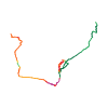
Skitour · Tirol. Die veröffentlichte Linie ist 8,2 km lang.
Kartenebenen
Tour mitnehmen
GPX herunterladen ↓Originale Routenlinie mit geschätzten Höhen aus unserem Höhenmodell. Ohne Anmeldung oder App nutzbar.
ODbL 1.0 + CC BY-SA 3.0 FR · Lizenz. Quellenangaben sind in der Datei enthalten.
- Höchster Punkt
- ≈ 2.802 m
Kurzbeschreibung laut Quelle
Rather short and straightforward tour to a summit with great view, can be made even shorter by using the cable cars. The traverse via the NE-slopes adds great skiing terrain with good orientation. The bus down in the valley runs every hour to get back.
Wegbeschreibung laut Quelle
## Ascent
From Kühtai, head up the slopes to the top station of the Drei-Seen Bahn. Then continue SE and ascend the obvious couloir leading to the SW-ridge. Typically, one can still continue a bit on skis before bootpacking the last ca. 100m to the summit with a big cross.
## Descent
Directly from the summit, a short (ca. 20m) narrow (3m) couloir gives access to the large NE-face. Descend the face and continue after a flat section NE towards Haggen or in a steeper forest N to the Zirmbachalm.
Hinweise laut Quelle
* Typically, no gear is needed for reaching the summit or descending the short couloir (side-steeping on skis). Ice axe, crampons are useful in case of hard-packed/icy snow.
Die Karte zeigt die veröffentlichte Linie. Auf- und Abstieg aus der Quelle bleiben deren Originalangaben; Schätzungen entlang der Linie sind mit ≈ markiert. Ein zusätzlicher Rückweg ist nicht automatisch in der Linie enthalten. Höhenprofil aus Copernicus DEM, geschätzt. Anbieterwerte können davon abweichen.
Wetter · nächste 48 Stunden
Wetter wird geladen …
BULLETIN
Lawinenlage in den Tourenregionen
Berichtsregionen entlang der Linie: AT-07-09, AT-07-14-02, AT-07-14-03
Aktuelle Gefahr und Gültigkeit im amtlichen Bericht prüfen. Lawinenwarndienste
Regionale Lawinenberichte bewerten keine einzelne Tour. Beachte Gültigkeit, Höhenlage und Exposition.
NATUR · NATURE
Unterwegs im Schutzgebiet
Ruhegebiet Stubaier Alpen
Ruhegebiet
Kartendarstellung vereinfacht; maßgeblich ist die verlinkte Originalquelle.
Auf dem iPhone öffnen · QR
Quelle & Datenstand
Camptocamp · Borut, flints7one · https://www.camptocamp.org/routes/1891698 · Coordinates reprojected; DEM elevation estimates · ODbL 1.0 + CC BY-SA 3.0 FR
Camptocamp · 2026-04-08T07:58:45.990880+00:00
Produced using Copernicus WorldDEM-30 © DLR e.V. 2010-2014 and © Airbus Defence and Space GmbH 2014-2018 provided under COPERNICUS by the European Union and ESA; all rights reserved.
Tour-ID: c2c:route/1891698 · Revision: 8f9ba8eb904b