
GeoSphere Austria · Quellen
Höhenprofil
Schneehöhe
Modell · 1 kmSchneemodell wird geladen …
- Strecke
- 8,7 km
- Aufstieg
- 940 m
- Abstieg laut Quelle
- 940 m
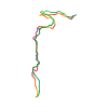
Skitour · Kanton Waadt. Die veröffentlichte Linie ist 8,7 km lang.
Kartenebenen
Tour mitnehmen
GPX herunterladen ↓Originale Routenlinie mit geschätzten Höhen aus unserem Höhenmodell. Ohne Anmeldung oder App nutzbar.
ODbL 1.0 + CC BY-SA 3.0 FR · Lizenz. Quellenangaben sind in der Datei enthalten.
- Höchster Punkt
- ≈ 1.806 m
Wegbeschreibung laut Quelle
*Scenic path, full of alps huts.*
[img=960736 right][/img]
**Ascent :**
From Leoutre (carpark), take the forest road up to the end, or shorten up in the forest by the pedest path. From the alp hut in the end of the road (Colatel), go up through pastures and glades, to the south, until summit.
You can follow the crest until Croix de Javerne, but it is not better downskiing!
Hinweise laut Quelle
- Nice sightseeing on the Rhoneriver.
- Easy and safe outing, especially by big avalanche danger or with beginners, with nice ski.
Kurzbeschreibung laut Quelle
Itinéraire très pittoresque, plein de jolis chalets d'alpage. Un grand classique s'il y a de la neige jusqu'à basse altitude, en général très fréquenté.
Wegbeschreibung laut Quelle
[img=960736 right][/img]
##Montée
De Leoutre, prendre la route forestière qui part de la scierie, puis la suivre, passer l'épingle suivant le pt 1026 et revenir sur les Colatels, ou alors couper dans la forêt par un chemin pédestre juste après le pont.
Des chalets des Colatels, remonter les pâturages et clairières, direction S, en passant par le chalet situé à 1442 m, puis par celui à 1601 m. De là, prendre sur la gauche pour contourner la langue de forêt, puis revenir sur la crête à droite. Puis suivre la crête jusqu'au sommet.
Possibilité de continuer jusqu'à la [Croix de Javerne](http://www.camptocamp.org/summits/37243/fr/croix-de-javerne), mais cela n'apporte rien du point de vue du ski.
##Descente
Par le même itinéraire.
Hinweise laut Quelle
- Ce sommet n'est en fait qu'une simple protubérance sur la longue crête qui conduit à la Croix de Javerne. Jolie vue sur la plaine du Rhône.
- Course très facile et sûre, idéale en cas de fort danger d'avalanches ou comme initiation, avec toutefois de jolies pentes à skier.
- Possibilité d'apercevoir (de loin) l'itinéraire sur la webcam de [Gryon Les Chaux](https://villars.roundshot.co/leschaux/).
Die Karte zeigt die veröffentlichte Linie. Auf- und Abstieg aus der Quelle bleiben deren Originalangaben; Schätzungen entlang der Linie sind mit ≈ markiert. Ein zusätzlicher Rückweg ist nicht automatisch in der Linie enthalten. Höhenprofil aus Copernicus DEM, geschätzt. Anbieterwerte können davon abweichen.
Wetter · nächste 48 Stunden
Wetter wird geladen …
BULLETIN
Lawinenlage in den Tourenregionen
Berichtsregionen entlang der Linie: Bex - Villars
Regionale Lawinenberichte bewerten keine einzelne Tour. Beachte Gültigkeit, Höhenlage und Exposition.
NATUR · NATURE
Unterwegs im Schutzgebiet
Im verfügbaren Datenbestand ist entlang der Linie kein Schutzgebiet gefunden. Lokale Hinweise bleiben maßgeblich.
Auf dem iPhone öffnen · QR
Quelle & Datenstand
Camptocamp · Camptocamp-Association, Céline Stern-Kiener, Christian, alexduchablais, Thomas Ribière, Josep Sola, David Bochot, Thomas Charbonneau, Compte Modération Topoguide, Daniel Ribagnac, Gnaffron, Jérémy Cherix, Choucroute, rabot, botopo, CaBot · https://www.camptocamp.org/routes/45310 · Coordinates reprojected; DEM elevation estimates · ODbL 1.0 + CC BY-SA 3.0 FR
Camptocamp · 2021-01-19T18:11:49.113617+00:00
Produced using Copernicus WorldDEM-30 © DLR e.V. 2010-2014 and © Airbus Defence and Space GmbH 2014-2018 provided under COPERNICUS by the European Union and ESA; all rights reserved.
Tour-ID: c2c:route/45310 · Revision: c13bad410ca6