
GeoSphere Austria · Quellen
Höhenprofil
Schneehöhe
Modell · 1 kmSchneemodell wird geladen …
- Strecke
- 10,7 km
- Aufstieg
- 970 m
- Abstieg laut Quelle
- 970 m
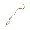
Skitour · Kanton Wallis. Die veröffentlichte Linie ist 10,7 km lang.
Kartenebenen
Tour mitnehmen
GPX herunterladen ↓Originale Routenlinie mit geschätzten Höhen aus unserem Höhenmodell. Ohne Anmeldung oder App nutzbar.
ODbL 1.0 + CC BY-SA 3.0 FR · Lizenz. Quellenangaben sind in der Datei enthalten.
- Höchster Punkt
- ≈ 2.556 m
Wegbeschreibung laut Quelle
##Approach
From La Fouly continue up the road and park at the hamlet of Le Clou, (Also known as Les Granges, eg on bus stop sign.) The road normally ends here in winter, the continuation being a ski piste.
##Ascent
From here follow the road/piste for about 200m until it is possible to go down on the right to a bridge over the river. Cross the ski du fond piste and climb upwards towards the Gite de la Léchère (small signpost at start of the climb.) You firstly pass a small wooden chalet (1780m) before seeing the gite higher up on your right.
(*N.B. If there is no parking left near the end of the road, it is possible to start lower down, half way towards La Fouly, and cross the river at a lower bridge. A path directly opposite the crossing takes you up to a broader track which is then followed almost horizontally for a couple of hundred metres to the gite mentioned above.)*
Continue up a little combe to E of the "Cretté de la Gouille" until Point 2141m. From here traverse along the N side of the Cretté de la Perche, go past a false col into the Combe des Fonds. At about 2270m, go diagonally to the left to climb steeply to the top of large mound above Point 2370m (Planfins de la Léchère). From here it is possible to continue to the Tete de Ferret, (see associated route above.) Instead go SW to the summit of "Le Chantonnet", which overlooks the "Petit Col Ferret".
##Descent
By the same route. Be careful at the Crette de la Perche: windslab or a thin covering over stoney ground, (ski wrecking.) Check on the way up.
In good conditions several variants are possible for the descent.
Hinweise laut Quelle
Faces mainly N with the start facing E.
The Planfins de la Léchère catches the sun making it an excellent place for a picnic, (likewise the little chalet at 1780m.)
Wegbeschreibung laut Quelle
##Montée
De la Fouly, gagner le hameau du Clou (Les Granges sur CN) sur la route de Ferret.
Depuis les Granges, suivre la route sur environ 200 m, puis prendre le chemin qui rejoint les pistes de ski de fond, traverser le pont et monter en direction de la Léchère dessous (gîte), puis dessus.
S'élever ensuite dans une petite combe à l'E du Cretté de la Gouille jusqu'au pt 2141 m.
De là, le long du flanc N du Cretté de la Perche, gagner le haut de la combe des Fonds. Vers le pt 2271, obliquer franchement à gauche dans une pente plus raide pour monter sur la large croupe au-dessus du point 2370 m (Planfins de la Léchère).
Prendre direction SW jusqu'au sommet du Chantonnet qui domine le Petit col Ferret.
##Descente
* Par le même itinéraire. Attention au Crette de la Perche : plaques à vent ou faible couche de neige sur des cailloux très dommageables pour les semelles, à évaluer à la montée.
* Par bonnes conditions, prendre assez tôt (dès 2450 m) en direction de la Combe des Fonds.
Ensuite, 2 options :
1. Suivre à droite, vers le col La Gouille (2141 m) pour rejoindre le Vallon du Cretté de la Gouille.
2. Suivre la Combe des Fonds jusqu'au Darbé, remonter sur la digue à droite, et par quelques clairières, rejoindre le hameau du Clou.
Hinweise laut Quelle
* Orientation principale N et départ exposé E.
Die Karte zeigt die veröffentlichte Linie. Auf- und Abstieg aus der Quelle bleiben deren Originalangaben; Schätzungen entlang der Linie sind mit ≈ markiert. Ein zusätzlicher Rückweg ist nicht automatisch in der Linie enthalten. Höhenprofil aus Copernicus DEM, geschätzt. Anbieterwerte können davon abweichen.
Wetter · nächste 48 Stunden
Wetter wird geladen …
BULLETIN
Lawinenlage in den Tourenregionen
Berichtsregionen entlang der Linie: Val d'Entremont - Val Ferret
Regionale Lawinenberichte bewerten keine einzelne Tour. Beachte Gültigkeit, Höhenlage und Exposition.
NATUR · NATURE
Unterwegs im Schutzgebiet
Val Ferret / Combe de l'A
Bundesinventar der eidgenössischen Jagdbanngebiete
Kartendarstellung vereinfacht; maßgeblich ist die verlinkte Originalquelle.
Auf dem iPhone öffnen · QR
Quelle & Datenstand
Camptocamp · Camptocamp-Association, Céline Stern-Kiener, Christian, Gus Morton, Matkinson, rabot, pioletdo · https://www.camptocamp.org/routes/46555 · Coordinates reprojected; DEM elevation estimates · ODbL 1.0 + CC BY-SA 3.0 FR
Camptocamp · 2022-01-21T08:00:19.079891+00:00
Produced using Copernicus WorldDEM-30 © DLR e.V. 2010-2014 and © Airbus Defence and Space GmbH 2014-2018 provided under COPERNICUS by the European Union and ESA; all rights reserved.
Tour-ID: c2c:route/46555 · Revision: e66a1ab76404