
GeoSphere Austria · Quellen
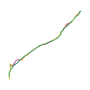
Höhenprofil
Schneehöhe
Modell · 1 kmSchneemodell wird geladen …
- Strecke
- 7,3 km
- Aufstieg
- 865 m
- Abstieg laut Quelle
- 865 m
Skitour · Kanton Wallis. Die veröffentlichte Linie ist 7,3 km lang.
Kartenebenen
Tour mitnehmen
GPX herunterladen ↓Originale Routenlinie mit geschätzten Höhen aus unserem Höhenmodell. Ohne Anmeldung oder App nutzbar.
ODbL 1.0 + CC BY-SA 3.0 FR · Lizenz. Quellenangaben sind in der Datei enthalten.
- Höchster Punkt
- ≈ 2.080 m
Wegbeschreibung laut Quelle
##Access
[img=158934 right]Chalets et Mont de l'Arpille[/img]
Take the road from Col de Forclaz towards Martigny and turn off on the left towards Ravoire. Take a left turn at a signpost for Chez les Pillet. Continue up this road until just after a hairpin at a large boulder turn left again for "Chez Pillet". (You are following the Route d'Arpille, but ignore a very acute turn off lower down on the left, signposted for walkers but restricted access for cars.) A last turn off to the left leads in a short distance to a parking (1340m) at the bifurcation in the road. The "Buvette du Grizzli" is here, (a very small tea shack.)
##Ascent
Follow a path which leaves uphill of the right hand road just after the parking, signposted for walkers/snowshoers, going SW to the plateau de l'Arpille (1816m) passing the chalets de la Clairière La Barme (1380m). From the plateau, go up to a little col to the S of Pointe 1855m. Pass to the N of a buttress from Point 2051m to reach the Mont de l'Arpille summit (2085m). It is also possible to go up directly between Points 2051m and 2085m.
##Descent
By the same route or go about 100m towards the Col de Forclaz and descend the E face via the Point 1961 to reach the chalets de l'Arpille. From there regain la Clairière La Barme by the forest track, and then the road back to the parking, (depending on snow cover.)
Hinweise laut Quelle
A short pleasant tour with good views, recommended for beginners, early season, (or bad weather higher up.)
The route faces NE, but still gets the sun.
The route is signposted and very popular for snowshoers. Avoid on sunny Sundays.
Limited parking is also possible in Ravoire at the hamlet of Rapperins (1210m.) Path also signposted.
Wegbeschreibung laut Quelle
[img=158934 right]Chalets et Mont de l'Arpille[/img]
##Montée
Sur le coteau de Ravoire, poursuivre jusqu'au hameau des Rapperins (1210 m) où se trouve un parking. De là, suivre un chemin et les écriteaux du tourisme pédestre qui conduisent direction SW au plateau de l'Arpille (1816 m) en passant par les chalets de la clairière La Barme (1380 m). De là, monter à un petit col au S au point 1855 m, tourner par le N la proéminence du point 2051 m et gagner le sommet du Mont de l'Arpille (2085 m). Possibilité aussi de monter plus directement entre les points 2051 et 2085.
##Descente
Même itinéraire ou descendre directement du sommet sur le versant E par le point 1961 m pour gagner les chalets de l'Arpille. De là, en restant au-dessus de la trace de montée rejoindre la clairière La Barme par le chemin forestier.
Hinweise laut Quelle
- Joli sommet pour une course d'initiation ou de début de saison. Superbe panorama.
- Course ensoleillée d'orientation NE.
- L'itinéraire est balisé comme sentier raquette.
- Il est possible de partir du parking près du réservoir (1350 m) après le lacet de Chez Pillet.
Die Karte zeigt die veröffentlichte Linie. Auf- und Abstieg aus der Quelle bleiben deren Originalangaben; Schätzungen entlang der Linie sind mit ≈ markiert. Ein zusätzlicher Rückweg ist nicht automatisch in der Linie enthalten. Höhenprofil aus Copernicus DEM, geschätzt. Anbieterwerte können davon abweichen.
Wetter · nächste 48 Stunden
Wetter wird geladen …
BULLETIN
Lawinenlage in den Tourenregionen
Berichtsregionen entlang der Linie: Emosson
Regionale Lawinenberichte bewerten keine einzelne Tour. Beachte Gültigkeit, Höhenlage und Exposition.
NATUR · NATURE
Unterwegs im Schutzgebiet
Arpille
Waldreservate
Kartendarstellung vereinfacht; maßgeblich ist die verlinkte Originalquelle.
Auf dem iPhone öffnen · QR
Quelle & Datenstand
Camptocamp · Camptocamp-Association, Christian, alexduchablais, Thomas Ribière, Marc Kia, lent, Gus Morton, Compte Modération Topoguide, rabot · https://www.camptocamp.org/routes/47461 · Coordinates reprojected; DEM elevation estimates · ODbL 1.0 + CC BY-SA 3.0 FR
Camptocamp · 2018-03-28T00:16:19.313998+00:00
Produced using Copernicus WorldDEM-30 © DLR e.V. 2010-2014 and © Airbus Defence and Space GmbH 2014-2018 provided under COPERNICUS by the European Union and ESA; all rights reserved.
Tour-ID: c2c:route/47461 · Revision: ac7261a7a3ec