
GeoSphere Austria · Quellen
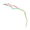
Höhenprofil
Schneehöhe
Modell · 1 kmSchneemodell wird geladen …
- Strecke
- 10,0 km
- Aufstieg
- 950 m
- Abstieg laut Quelle
- 950 m
Skitour · Département Haute-Savoie. Die veröffentlichte Linie ist 10,0 km lang.
Kartenebenen
Tour mitnehmen
GPX herunterladen ↓Originale Routenlinie mit geschätzten Höhen aus unserem Höhenmodell. Ohne Anmeldung oder App nutzbar.
ODbL 1.0 + CC BY-SA 3.0 FR · Lizenz. Quellenangaben sind in der Datei enthalten.
- Höchster Punkt
- ≈ 2.085 m
Wegbeschreibung laut Quelle
Von der Siedlung Bonnavaz (1187m) oder vom Pass Encrenaz (1433m) der Straße bis zu den Berghütten von Foron (1355m) folgen. Die Mulde von Foron nordwestlich über das Foron du Milieu (1499m) und das unterhalb eines kleinen Plateaus liegende Foron d'en Haut (~1680m) hinaufsteigen. Dieses Plateau stets nordwestlich queren und leicht rechts den Pass von Foron (1832m) erreichen.
Über eine aufsteigende Traverse links (SW) zum Pass von Chalune (1896m) gelangen, der Zugang zur SSO-Seite der Pointe de Chalune gibt. Direkt nördlich zum breiten, etwas schrägen Ost-Grat aufsteigen, dem man bis zum Gipfel von Chalune folgt.
Abfahrt: Zwei Möglichkeiten: - über die Aufstiegsroute (klassische Strecke); - über die ausgedehnte SSO-Seite von Chalune und die Traverse des Passes von Bolire (1649m), über den man die Mulde von Foron erreicht. Sehr kurze S4-Passagen, wenn man vom Gipfel direkt auf Skiern startet.
Hinweise laut Quelle
Die Starthöhe ab dem Pass von Encrenaz (1433m) ist höher als jene von Bonnavaz (1187m) und der Berghütten von Foron (1355m). Die Strecke beginnt mit einer Abfahrt über 80m auf der Straße, die man auf dem Rückweg wieder hinauf muss.
Hin-und Rückweg über die Aufstiegsstrecke (Mulde von Foron) sind klassische, ziemlich leichte Strecken. PD -, S2 mit S3-Passagen. Die Abfahrt der SSO-Seite ist anspruchsvoller: fast 35°/250m nach Labande. Einige etwas steilere und enge, aber kurze Passagen, beim Start vom Gipfel nicht zwingend. PD +, S3 durchgehend, teilweise S4.
Alle Abhänge sind süd-/südöstlich ausgerichtet und deshalb schnell der Sonne ausgesetzt.
Zugang:
Von Taninges über die Brücke von Gets, Morzine/St. Jean d'Aulps, Essert-Romand und schließlich den Pass von Encrenaz nach Les Gets gelangen. Wenn man von Bonnavaz aufbricht, muß man die Straße von Gets an der Brücke von Gets in Richtung Praz de Lys verlassen.
Wegbeschreibung laut Quelle
From the hamlet of Bonnavaz (1187m) or Encrenaz pass (1433m), follow the road until the Foron chalets (1355m). Then go up the scoop of Foron towards the NW first passing Foron du Milieu (1499m) then Foron d'en Haut (~1680m) located at the base of a small plateau. Always traverse this plateau towards the NW and reach slightly on the right the Foron pass (1832m).
Via an ascending traverse on the left (SW), you reach the Chalune pass (1896m) which gives access to the SSE face of Pointe de Chalune. Climb directly N to reach the E ridge, which is broad and not very inclined, follow it as far as the Chalune summit.
Descent: two possibilities: -by the uphill route (classic route); -via the broad SSE face of Chalune and the traverse of the Bolire pass(1649m) which makes it possible to reach the scoop of Foron. Very short sections of S4 if you start directly from the summit on skis.
Hinweise laut Quelle
The starting altitude from Encrenaz pass (1433m) is higher than that of Bonnavaz (1187m) and the Foron chalets (1355m). The route starts with an 80m descent on the road that you have to go back up on the way back.
The round trip by the way up route (scoop of Foron) is very classic and not difficult: PD -, S2 with S3 sections. The descent of the SSE face is more unrelenting: almost 35°/250m after le Labande. Some slightly steeper and narrower sections but short and non obligatory to the start of the summit. PD +, unrelenting S3, sections in S4.
All the slopes face S to SE and thus are quickly exposed to the sun.
Access:
From Taninges, go to Les Gets via the Pont des Gets then Morzine/St Jean d'Aulps, Essert-Romand and finally Col de l'Encrenaz. If you start from from Bonnavaz, leave the Gets road at Pont des Gets and go towards Praz de Lys.
Wegbeschreibung laut Quelle
Dal piccolo villaggio di Bonnavaz (1187m) o dal col de l'Encrenaz (1433m), seguire la strada fino agli chalet del Foron (1355m). Risalire allora la combe du Foron verso NW passando inizialmente da Foron du Milieu (1499m) poi da Foron d'en Haut (~1680m) situato in fondo ad un piccolo ripiano. Traversare questo ripiano sempre verso NW e raggiungere leggermente sulla destra il col du Foron (1832m).
Con una traversata ascendente sulla sinistra (SW), raggiungere il col de Chalune (1896m) che dà accesso alla parete SSE della Punta di Chalune. Salire direttamente a N per raggiungere la cresta E, ampia e poco inclinata, che si segue fino alla vetta di Chalune.
Discesa: due possibilità: - dalla via di salita (itinerario classico); - attraverso la vasta parete SSE di Chalune e la traversata del col de Bolire (1649m) che permette di raggiungere la combe du Foron. Brevissimi passaggi di S4 se si parte direttamente dalla cima con gli sci.
Hinweise laut Quelle
La quota di partenza dal col de l'Encrenaz (1433m) è più elevata di quella di Bonnavaz (1187m) e degli chalet del Foron (1355m). L'itinerario comincia con una discesa di 80m sulla strada che bisognerà risalire al ritorno.
L'andata e il ritorno dall'itinerario di salita (combe du Foron) è molto classica e poco difficile: PD -, S2 con passaggi di S3. La discesa della parete SSE è più sostenuta: quasi 35°/250m secondo Labande. Alcuni passaggi un po' più ripidi e stretti ma brevi e non obbligatori alla partenza dalla vetta. PD+, S3 sostenuto, passaggi in S4.
Tutti i pendii sono orientati da S a SE e sono quindi esposti al sole molto presto.
Accesso :
Da Taninges, raggiungere Les Gets dal Pont des Gets quindi Morzine/St Jean di Aulps, Essert-Romand e finalmente il Col de l'Encrenaz. Se si parte da Bonnavaz, occorre abbandonare la strada dei Gets al Pont des Gets e proseguire in direzione di Praz de Lys.
Wegbeschreibung laut Quelle
[img=204124 right]Chalune (S)[/img]
##Montée
De Bonnavaz (1187 m) ou du col de l'Encrenaz (1433 m), suivre la route jusqu'aux chalets du Foron (1355 m). Remonter alors la combe du Foron vers le NW en passant d'abord au Foron du Milieu (1499 m) puis au Foron d'en Haut (~1680m) situé au bas d'un petit plateau. Traverser ce plateau toujours vers le NW et atteindre légèrement sur la droite le col du Foron (1832 m).
Par une traversée ascendante sur la gauche (SW), rejoindre le col de Chalune (1896 m) qui donne accès à la face SSE de la Pointe de Chalune. Monter directement au N pour rejoindre l'arête E, large et peu inclinée, la suivre jusqu'au sommet.
##Descente
*2 possibilités*
- Par la voie de montée (itinéraire classique) ;
- Par la vaste face SSE de Chalune et la traversée du col de Bolire (1649 m) qui permet de rejoindre la combe du Foron. Très courts passages de S4 si on part directement du sommet à ski.
Hinweise laut Quelle
- L'altitude de départ depuis le col de l'Encrenaz (1433 m) est plus élevée que celle de Bonnavaz (1187 m) et des chalets du Foron (1355 m). L'itinéraire commence alors par une descente de 80 m sur la route qu'il faudra remonter au retour.
- L'aller-retour par l'itinéraire de montée (combe du Foron) est très classique et peu difficile : PD-, S2 avec passages de S3.
- La descente de la face SSE est plus soutenue ; presque 35°/250m d'après le Labande. Quelques passages un peu plus raides et étroits mais courts et non obligatoires au départ du sommet. PD+, S3 soutenu, passages en S4.
- Toutes les pentes sont orientées de S à SE et sont donc rapidement exposées au soleil.
Die Karte zeigt die veröffentlichte Linie. Auf- und Abstieg aus der Quelle bleiben deren Originalangaben; Schätzungen entlang der Linie sind mit ≈ markiert. Ein zusätzlicher Rückweg ist nicht automatisch in der Linie enthalten. Höhenprofil aus Copernicus DEM, geschätzt. Anbieterwerte können davon abweichen.
Wetter · nächste 48 Stunden
Wetter wird geladen …
BULLETIN
Lawinenlage in den Tourenregionen
Für diese Linie ist hier keine EUREGIO-Berichtsregion hinterlegt.
Aktuelle Gefahr und Gültigkeit im amtlichen Bericht prüfen. Lawinenwarndienste
Regionale Lawinenberichte bewerten keine einzelne Tour. Beachte Gültigkeit, Höhenlage und Exposition.
NATUR · NATURE
Unterwegs im Schutzgebiet
Col Ratti
Arrêté de protection de biotope
Kartendarstellung vereinfacht; maßgeblich ist die verlinkte Originalquelle.
Auf dem iPhone öffnen · QR
Quelle & Datenstand
Camptocamp · Camptocamp-Association, Christian, alexduchablais, lent, Herve Sergeraert, Sophie Ferlin, sissssou, Antoine Marnat, rabot · https://www.camptocamp.org/routes/45214 · Coordinates reprojected; DEM elevation estimates · ODbL 1.0 + CC BY-SA 3.0 FR
Camptocamp · 2020-05-17T20:29:16.411268+00:00
Produced using Copernicus WorldDEM-30 © DLR e.V. 2010-2014 and © Airbus Defence and Space GmbH 2014-2018 provided under COPERNICUS by the European Union and ESA; all rights reserved.
Tour-ID: c2c:route/45214 · Revision: 739e9c0fe563