
GeoSphere Austria · Quellen
Höhenprofil
Schneehöhe
Modell · 1 kmSchneemodell wird geladen …
- Strecke
- 10,3 km
- Aufstieg
- 1.073 m
- Abstieg laut Quelle
- 1.073 m
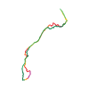
Skitour · Kanton Wallis. Die veröffentlichte Linie ist 10,3 km lang.
Kartenebenen
Tour mitnehmen
GPX herunterladen ↓Originale Routenlinie mit geschätzten Höhen aus unserem Höhenmodell. Ohne Anmeldung oder App nutzbar.
ODbL 1.0 + CC BY-SA 3.0 FR · Lizenz. Quellenangaben sind in der Datei enthalten.
- Höchster Punkt
- ≈ 2.701 m
Wegbeschreibung laut Quelle
## Ascent
Cross the river Drance de Ferret just under Les Granges, then follow the Nordic ski piste for several hundreds of metres. Go up to the right on a track, that you quickly leave, to reach the Lechère chalet. Climbing diagonally left brings you to a large slope, which you go up more or less directly, to a little cwm at the top of the crest of the Gouille. Follow this snow bowl to the Gouille and bypass it to the right of the crest of the Perche. Then go directly to the foot of the final slope, (N face) and climb it by the easiest line.
##Descent
By the same way, many possibilities.
Hinweise laut Quelle
Climbing nearly all the way
If you set off to the left of the summit, looking up, the route becomes PD and S3.
The summit slope of the Tête de Ferret faces N, the rest faces mostly NE.
Windslab risk near the summit, (direct descent).
Wegbeschreibung laut Quelle
##Montée
Traverser la Drance de Ferret juste sous Les Granges, puis suivre quelques centaines de mètres la piste de ski de fond. Monter ensuite à droite (chemin que l'on quitte très vite) pour accéder au chalet de Lechère. Une montée oblique à gauche mène à une grande pente, la remonter plus ou moins directement pour atteindre le bout de la petite combe au sommet du crêtet de la Gouille. Suivre cette combe jusqu'à La Gouille et la contourner par la droite du crêtet de la Perche. Accéder ensuite directement au pied de la face et la remonter au plus facile.
##Descente
Par le même itinéraire ou par une des nombreuses variantes.
Hinweise laut Quelle
- Peu de plat.
- Si on ne part pas directement sous le sommet mais plus à gauche (en montant) cela devient PD et S3.
- La face de la Tête de Ferret est orientée N, le reste de la descente plutôt NE.
- Risque de plaque dans le sommet de la face (descente directe).
Die Karte zeigt die veröffentlichte Linie. Auf- und Abstieg aus der Quelle bleiben deren Originalangaben; Schätzungen entlang der Linie sind mit ≈ markiert. Ein zusätzlicher Rückweg ist nicht automatisch in der Linie enthalten. Höhenprofil aus Copernicus DEM, geschätzt. Anbieterwerte können davon abweichen.
Wetter · nächste 48 Stunden
Wetter wird geladen …
BULLETIN
Lawinenlage in den Tourenregionen
Berichtsregionen entlang der Linie: Val d'Entremont - Val Ferret
Regionale Lawinenberichte bewerten keine einzelne Tour. Beachte Gültigkeit, Höhenlage und Exposition.
NATUR · NATURE
Unterwegs im Schutzgebiet
Val Ferret / Combe de l'A
Bundesinventar der eidgenössischen Jagdbanngebiete
Kartendarstellung vereinfacht; maßgeblich ist die verlinkte Originalquelle.
Auf dem iPhone öffnen · QR
Quelle & Datenstand
Camptocamp · Camptocamp-Association, Céline Stern-Kiener, Christian, alexduchablais, Gus Morton, botopo · https://www.camptocamp.org/routes/45224 · Coordinates reprojected; DEM elevation estimates · ODbL 1.0 + CC BY-SA 3.0 FR
Camptocamp · 2018-08-16T01:21:39.548307+00:00
Produced using Copernicus WorldDEM-30 © DLR e.V. 2010-2014 and © Airbus Defence and Space GmbH 2014-2018 provided under COPERNICUS by the European Union and ESA; all rights reserved.
Tour-ID: c2c:route/45224 · Revision: dbffee523661