
GeoSphere Austria · Quellen
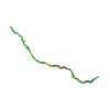
Höhenprofil
Schneehöhe
Modell · 1 kmSchneemodell wird geladen …
- Strecke
- 16,5 km
- Aufstieg
- 1.700 m
- Abstieg entlang der Linie
- ≈ 1.701 m
Skitour · Tirol. Die veröffentlichte Linie ist 16,5 km lang.
Kartenebenen
Tour mitnehmen
GPX herunterladen ↓Originale Routenlinie mit geschätzten Höhen aus unserem Höhenmodell. Ohne Anmeldung oder App nutzbar.
ODbL 1.0 + CC BY-SA 3.0 FR · Lizenz. Quellenangaben sind in der Datei enthalten.
- Höchster Punkt
- ≈ 3.228 m
Kurzbeschreibung laut Quelle
Great and long ski tour in a remote valley, even though it is ending at a ski lift of the Hintertuxer Gletscher. The Olperer stays always in focus. The description herein ends at the Wildlahnerscharte, though the Olperer can be reached via the N-ridge (PD/2-3, mixed/rock).
Wegbeschreibung laut Quelle
From the parking, follow the road on the river left side into the Wildlahnertal, which ends a bit before a small hut at 2100. Then, continue SE ascending the large NW/W-face towards the Olperer. At around 2700, head more towards S to circumvent the Wildlahnergrat. Then, head towards E on the rocky face that the Olperer glacier left behind. You reach the glacier terrace at around 3100. Continue towards E to reach the Wildlahnerscharte. You can hear and see the ski lift coming up from the other side. See GPS.
Descend like the ascend with some variations on the way.
Hinweise laut Quelle
* Glacier equipment is typically not required for this route (to be verified).
* The route is never steep (<35°) though the elevation gain is made continuously.
Die Karte zeigt die veröffentlichte Linie. Auf- und Abstieg aus der Quelle bleiben deren Originalangaben; Schätzungen entlang der Linie sind mit ≈ markiert. Ein zusätzlicher Rückweg ist nicht automatisch in der Linie enthalten. Höhenprofil aus Copernicus DEM, geschätzt. Anbieterwerte können davon abweichen.
Wetter · nächste 48 Stunden
Wetter wird geladen …
BULLETIN
Lawinenlage in den Tourenregionen
Berichtsregionen entlang der Linie: AT-07-23-02
Aktuelle Gefahr und Gültigkeit im amtlichen Bericht prüfen. Lawinenwarndienste
Regionale Lawinenberichte bewerten keine einzelne Tour. Beachte Gültigkeit, Höhenlage und Exposition.
NATUR · NATURE
Unterwegs im Schutzgebiet
Im verfügbaren Datenbestand ist entlang der Linie kein Schutzgebiet gefunden. Lokale Hinweise bleiben maßgeblich.
Auf dem iPhone öffnen · QR
Quelle & Datenstand
Camptocamp · flints7one · https://www.camptocamp.org/routes/1857361 · Coordinates reprojected; DEM elevation estimates · ODbL 1.0 + CC BY-SA 3.0 FR
Camptocamp · 2025-12-23T18:00:04.252273+00:00
Produced using Copernicus WorldDEM-30 © DLR e.V. 2010-2014 and © Airbus Defence and Space GmbH 2014-2018 provided under COPERNICUS by the European Union and ESA; all rights reserved.
Tour-ID: c2c:route/1857361 · Revision: 5e00cead236d