
GeoSphere Austria · Quellen
Höhenprofil
Schneehöhe
Modell · 1 kmSchneemodell wird geladen …
- Strecke
- 9,1 km
- Aufstieg
- 1.050 m
- Abstieg laut Quelle
- 550 m
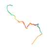
Skitour · Kanton Bern. Die veröffentlichte Linie ist 9,1 km lang.
Kartenebenen
Tour mitnehmen
GPX herunterladen ↓Originale Routenlinie mit geschätzten Höhen aus unserem Höhenmodell. Ohne Anmeldung oder App nutzbar.
ODbL 1.0 + CC BY-SA 3.0 FR · Lizenz. Quellenangaben sind in der Datei enthalten.
- Höchster Punkt
- ≈ 3.410 m
Kurzbeschreibung laut Quelle
Elegant away to leave (or access) the Aarbiwak, avoiding the long way from/to the Grimsel.
Wegbeschreibung laut Quelle
Overall, follow the trace indicated on swisstopo, respectively see the GPS. Key passages are:
* The traverse at ca. 3000m in the W-bowl of the Grunerhorn, ski crampons indispensable in spring.
* The W-couloir for accessing the Grunerhorn-ridge (Unteraar-side): short >40° at the top, tentative rating 4.1/E2.
* The S-sided access to the Grunerhorn-ridge (Oberaar-side): short (ca. 50m) but steep mixed terrain with unstable rock, can be annoying to descend with heavy back-pack and skis. See remarks.
Hinweise laut Quelle
* The S-sided mixed-terrain might look very different depending on the snow conditions. The associated pictures were taken in a rather dry state. In better conditions, less unstable rocks are probably present.
* If the route is used for leaving the Aarbiwak, the natural extension is to traverse the Galmilicke or Bächlilicke to the Goms. See the routes of the Oberaarjochhütte.
Die Karte zeigt die veröffentlichte Linie. Auf- und Abstieg aus der Quelle bleiben deren Originalangaben; Schätzungen entlang der Linie sind mit ≈ markiert. Ein zusätzlicher Rückweg ist nicht automatisch in der Linie enthalten. Höhenprofil aus Copernicus DEM, geschätzt. Anbieterwerte können davon abweichen.
Wetter · nächste 48 Stunden
Wetter wird geladen …
BULLETIN
Lawinenlage in den Tourenregionen
Berichtsregionen entlang der Linie: Schreckhorn, Grimselpass, Konkordia Gebiet
Regionale Lawinenberichte bewerten keine einzelne Tour. Beachte Gültigkeit, Höhenlage und Exposition.
NATUR · NATURE
Unterwegs im Schutzgebiet
Im verfügbaren Datenbestand ist entlang der Linie kein Schutzgebiet gefunden. Lokale Hinweise bleiben maßgeblich.
Auf dem iPhone öffnen · QR
Quelle & Datenstand
Camptocamp · flints7one · https://www.camptocamp.org/routes/1909123 · Coordinates reprojected; DEM elevation estimates · ODbL 1.0 + CC BY-SA 3.0 FR
Camptocamp · 2026-05-26T09:49:42.605412+00:00
Produced using Copernicus WorldDEM-30 © DLR e.V. 2010-2014 and © Airbus Defence and Space GmbH 2014-2018 provided under COPERNICUS by the European Union and ESA; all rights reserved.
Tour-ID: c2c:route/1909123 · Revision: e4669db5c7d3