
GeoSphere Austria · sources
Elevation profile
Snow depth
Model · 1 kmLoading snow model …
- Distance
- 9.1 km
- Ascent
- 1,050 m
- Descent from source
- 550 m
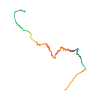
Ski tour · Kanton Bern. The published line is 9.1 km long.
Map layers
Take the route with you
Download GPX ↓Original route geometry with estimated elevations from our terrain model. No account or app required.
ODbL 1.0 + CC BY-SA 3.0 FR · Licence. Source credits are included in the file.
- Highest point
- ≈ 3,410 m
Source summary
Elegant away to leave (or access) the Aarbiwak, avoiding the long way from/to the Grimsel.
Source directions
Overall, follow the trace indicated on swisstopo, respectively see the GPS. Key passages are:
* The traverse at ca. 3000m in the W-bowl of the Grunerhorn, ski crampons indispensable in spring.
* The W-couloir for accessing the Grunerhorn-ridge (Unteraar-side): short >40° at the top, tentative rating 4.1/E2.
* The S-sided access to the Grunerhorn-ridge (Oberaar-side): short (ca. 50m) but steep mixed terrain with unstable rock, can be annoying to descend with heavy back-pack and skis. See remarks.
Source safety information
* The S-sided mixed-terrain might look very different depending on the snow conditions. The associated pictures were taken in a rather dry state. In better conditions, less unstable rocks are probably present.
* If the route is used for leaving the Aarbiwak, the natural extension is to traverse the Galmilicke or Bächlilicke to the Goms. See the routes of the Oberaarjochhütte.
The map shows the published line. Provider ascent and descent retain their original meaning; estimates along the line are marked ≈. An additional return route is not automatically included in the line. Elevation profile estimated from Copernicus DEM. Provider statistics may differ.
Weather · next 48 hours
Loading weather …
BULLETIN
Avalanche bulletins along this route
Bulletin regions along this line: Schreckhorn, Grimsel Pass, Konkordia region
Regional avalanche bulletins do not assess an individual route. Check validity, elevation and aspect.
NATUR · NATURE
Protected areas along the route
No protected area was found along this line in the available dataset. Follow local notices.
Open on your iPhone · QR
Source & data
Camptocamp · flints7one · https://www.camptocamp.org/routes/1909123 · Coordinates reprojected; DEM elevation estimates · ODbL 1.0 + CC BY-SA 3.0 FR
Camptocamp · 2026-05-26T09:49:42.605412+00:00
Produced using Copernicus WorldDEM-30 © DLR e.V. 2010-2014 and © Airbus Defence and Space GmbH 2014-2018 provided under COPERNICUS by the European Union and ESA; all rights reserved.
Tour-ID: c2c:route/1909123 · Revision: e4669db5c7d3