
GeoSphere Austria · Quellen
Höhenprofil
Schneehöhe
Modell · 1 kmSchneemodell wird geladen …
- Strecke
- 14,9 km
- Aufstieg
- 1.585 m
- Abstieg laut Quelle
- 1.585 m
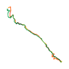
Skitour · Tirol. Die veröffentlichte Linie ist 14,9 km lang.
Kartenebenen
Tour mitnehmen
GPX herunterladen ↓Originale Routenlinie mit geschätzten Höhen aus unserem Höhenmodell. Ohne Anmeldung oder App nutzbar.
ODbL 1.0 + CC BY-SA 3.0 FR · Lizenz. Quellenangaben sind in der Datei enthalten.
- Höchster Punkt
- ≈ 3.403 m
Kurzbeschreibung laut Quelle
Skitour in high alpine environment from Vent without long valley approach. Very nice skiing terrain and steepness.
Wegbeschreibung laut Quelle
## Itinerary
From Vent, (parking at the cable car), the first part is the ascend to the Ramolalm (2200m), for which several possibilities exist: (a) in good snow condition, one can ascend the short ski lift at the south of the village and continue towards the Ramolalm in a sparse forest (see ascend GPS), (b) if snow is lacking, one can chose the summer trail (see descend GPS). From the Ramolalm, one continuous on the tree-free ridge/W-face and crosses at an appropriate point to the right (SW) into the valley (e.g. at 2500m, but higher is possible and less steep). One follows the NW-oriented valley until ca. 2800m, where a short but steep part to the right gives access to the small glacier (3000m). One keeps heading to the right on a NW-face. The last meters of it are steep and give access to a small ridge (3300m). On the other side of the ridge, one reaches the summit via the final N-face.
## Descent
By the route taken on the way up, with a few variations.
Hinweise laut Quelle
Several parts can be prone to avalanches : the traverse to the valley, the last meters of the NW-face and the face below the summit. The latter is moreover exposed to falling.
Ausrüstung laut Quelle
* Maybe iceaxe and crampons depending on the conditions under the summit
Kurzbeschreibung laut Quelle
Randonnée à ski en haute montagne depuis Vent, sans longue montée en vallée. Très beau domaine skiable et pente raide.
Wegbeschreibung laut Quelle
## Itinéraire
Depuis Vent (parking de la télécabine), la première partie est l'ascension du Ramolalm (2 200 m). Plusieurs possibilités s'offrent à vous :
1- Par bon enneigement, emprunter le court téléski au S du village et continuer vers le Ramolalm dans une forêt clairsemée (voir GPS de montée).
2- En cas de manque de neige, emprunter le sentier d'été (voir GPS de descente). Depuis le Ramolalm, continuer sur la crête (face W) sans arbres et traverser à droite (SW) la vallée (par exemple à 2 500 m, mais plus haut et moins raide possible). Suivre la vallée orientée NW jusqu'à environ 2 800 m, où une courte mais raide portion à droite donne accès au petit glacier (3 000 m). Continuer à droite sur une face NW. Les derniers mètres sont raides et mènent à une petite crête (3 300 m). De l'autre côté de l'arête, on accède au sommet par la face N finale.
## Descente
Par l'itinéraire emprunté à la montée, avec quelques variantes (voir trace GPS).
Die Karte zeigt die veröffentlichte Linie. Auf- und Abstieg aus der Quelle bleiben deren Originalangaben; Schätzungen entlang der Linie sind mit ≈ markiert. Ein zusätzlicher Rückweg ist nicht automatisch in der Linie enthalten. Höhenprofil aus Copernicus DEM, geschätzt. Anbieterwerte können davon abweichen.
Wetter · nächste 48 Stunden
Wetter wird geladen …
BULLETIN
Lawinenlage in den Tourenregionen
Berichtsregionen entlang der Linie: Weißkugelgruppe, Gurgler Gruppe
Aktuelle Gefahr und Gültigkeit im amtlichen Bericht prüfen. Lawinenwarndienste
Regionale Lawinenberichte bewerten keine einzelne Tour. Beachte Gültigkeit, Höhenlage und Exposition.
NATUR · NATURE
Unterwegs im Schutzgebiet
Ruhegebiet Ötztaler Alpen
Ruhegebiet
Kartendarstellung vereinfacht; maßgeblich ist die verlinkte Originalquelle.
Ötztal
Naturpark
Kartendarstellung vereinfacht; maßgeblich ist die verlinkte Originalquelle.
Auf dem iPhone öffnen · QR
Quelle & Datenstand
Camptocamp · janic, flints7one · https://www.camptocamp.org/routes/1761025 · Coordinates reprojected; DEM elevation estimates · ODbL 1.0 + CC BY-SA 3.0 FR
Camptocamp · 2025-04-20T13:35:16.589481+00:00
Produced using Copernicus WorldDEM-30 © DLR e.V. 2010-2014 and © Airbus Defence and Space GmbH 2014-2018 provided under COPERNICUS by the European Union and ESA; all rights reserved.
Tour-ID: c2c:route/1761025 · Revision: 0f0c74333692