
GeoSphere Austria · sources
Elevation profile
Snow depth
Model · 1 kmLoading snow model …
- Distance
- 14.9 km
- Ascent
- 1,585 m
- Descent from source
- 1,585 m
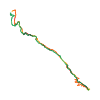
Ski tour · Tirol. The published line is 14.9 km long.
Map layers
Take the route with you
Download GPX ↓Original route geometry with estimated elevations from our terrain model. No account or app required.
ODbL 1.0 + CC BY-SA 3.0 FR · Licence. Source credits are included in the file.
- Highest point
- ≈ 3,403 m
Source summary
Skitour in high alpine environment from Vent without long valley approach. Very nice skiing terrain and steepness.
Source directions
## Itinerary
From Vent, (parking at the cable car), the first part is the ascend to the Ramolalm (2200m), for which several possibilities exist: (a) in good snow condition, one can ascend the short ski lift at the south of the village and continue towards the Ramolalm in a sparse forest (see ascend GPS), (b) if snow is lacking, one can chose the summer trail (see descend GPS). From the Ramolalm, one continuous on the tree-free ridge/W-face and crosses at an appropriate point to the right (SW) into the valley (e.g. at 2500m, but higher is possible and less steep). One follows the NW-oriented valley until ca. 2800m, where a short but steep part to the right gives access to the small glacier (3000m). One keeps heading to the right on a NW-face. The last meters of it are steep and give access to a small ridge (3300m). On the other side of the ridge, one reaches the summit via the final N-face.
## Descent
By the route taken on the way up, with a few variations.
Source safety information
Several parts can be prone to avalanches : the traverse to the valley, the last meters of the NW-face and the face below the summit. The latter is moreover exposed to falling.
Source equipment information
* Maybe iceaxe and crampons depending on the conditions under the summit
Source summary
Randonnée à ski en haute montagne depuis Vent, sans longue montée en vallée. Très beau domaine skiable et pente raide.
Source directions
## Itinéraire
Depuis Vent (parking de la télécabine), la première partie est l'ascension du Ramolalm (2 200 m). Plusieurs possibilités s'offrent à vous :
1- Par bon enneigement, emprunter le court téléski au S du village et continuer vers le Ramolalm dans une forêt clairsemée (voir GPS de montée).
2- En cas de manque de neige, emprunter le sentier d'été (voir GPS de descente). Depuis le Ramolalm, continuer sur la crête (face W) sans arbres et traverser à droite (SW) la vallée (par exemple à 2 500 m, mais plus haut et moins raide possible). Suivre la vallée orientée NW jusqu'à environ 2 800 m, où une courte mais raide portion à droite donne accès au petit glacier (3 000 m). Continuer à droite sur une face NW. Les derniers mètres sont raides et mènent à une petite crête (3 300 m). De l'autre côté de l'arête, on accède au sommet par la face N finale.
## Descente
Par l'itinéraire emprunté à la montée, avec quelques variantes (voir trace GPS).
The map shows the published line. Provider ascent and descent retain their original meaning; estimates along the line are marked ≈. An additional return route is not automatically included in the line. Elevation profile estimated from Copernicus DEM. Provider statistics may differ.
Weather · next 48 hours
Loading weather …
BULLETIN
Avalanche bulletins along this route
Bulletin regions along this line: Weißkugel Group, Gurgler Group
Check the official report for current danger and validity. Avalanche warning services
Regional avalanche bulletins do not assess an individual route. Check validity, elevation and aspect.
NATUR · NATURE
Protected areas along the route
Ruhegebiet Ötztaler Alpen
Ruhegebiet
Kartendarstellung vereinfacht; maßgeblich ist die verlinkte Originalquelle.
Ötztal
Naturpark
Kartendarstellung vereinfacht; maßgeblich ist die verlinkte Originalquelle.
Open on your iPhone · QR
Source & data
Camptocamp · janic, flints7one · https://www.camptocamp.org/routes/1761025 · Coordinates reprojected; DEM elevation estimates · ODbL 1.0 + CC BY-SA 3.0 FR
Camptocamp · 2025-04-20T13:35:16.589481+00:00
Produced using Copernicus WorldDEM-30 © DLR e.V. 2010-2014 and © Airbus Defence and Space GmbH 2014-2018 provided under COPERNICUS by the European Union and ESA; all rights reserved.
Tour-ID: c2c:route/1761025 · Revision: 0f0c74333692