For iPhone, iPad and Apple Watch
Your ski tour.
Your trail.
All in view.
How steep is the next climb? Where does my route go? How much elevation have I already gained? Hanglage brings your map, elevation profile and workout together.
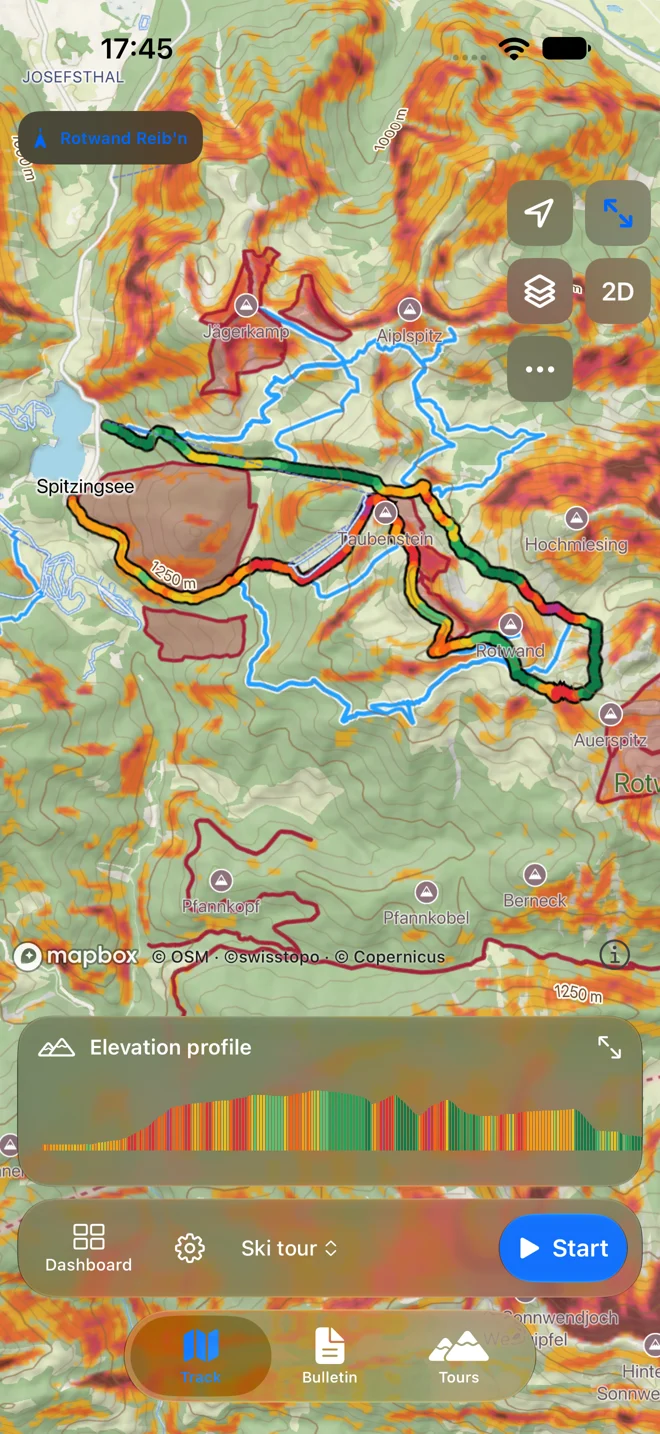
A map for your day in the mountains.
Paths, contours and terrain help you find your bearings. In the app, view the map in 2D or 3D and add terrain slope. Protected-area information is accessible right on the map.
See what lies ahead before you set off.
Discover ski and summer routes, explore the elevation profile and open your chosen route in the app. Bring your own GPX tracks too. Difficulty, season and refreshment information appear when provided by the source.
Keep your route in view without reception.
Download your map area to the iPhone before setting off. Routes and elevation profiles are included in the offline area. You can also prepare and download maps for your Apple Watch.
Your workout. Your numbers.
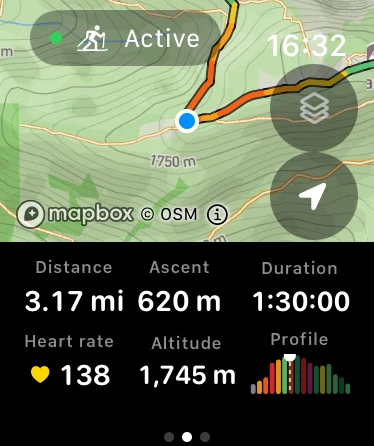
Start on the iPhone or Apple Watch. Distance, elevation gain, duration and available training metrics stay in view. Choose the dashboard fields that matter to you on the trail.
A glance at your wrist. Then keep going.
Your route, map, elevation profile and compact training metrics on Apple Watch. When the Watch records, you can also view the active workout on your iPhone.
Ski touring is still at the heart of Hanglage.
Regional avalanche bulletins and terrain slope are part of the app. They support your preparation; they cannot replace assessment of the conditions and the individual slope.
When summer comes, take it to the trails.
Switch to trail running or hiking. Your route, offline map, elevation profile and recording stay familiar. Original hiking-route information remains clearly labelled as such.
Why I build Hanglage.
I wanted to stop switching between my map, avalanche bulletin and workout recording on ski tours. That became Hanglage. The app grows out of what I need in the mountains – now for running and hiking too. I’m Bernhard, and I welcome specific ideas from people who use Hanglage outdoors.
Send Bernhard an idea ↗Common questions
Can I use Hanglage without Apple Watch?
Yes. Use maps and routes on your iPhone and start recording there too.
Can I use my own GPX tracks?
Yes. Import a GPX track into the app and use it as a route.
Is Hanglage available for Android?
Hanglage currently supports iPhone, iPad and Apple Watch. You can explore the web route map on other devices too.
Is every summer route suitable for trail running?
The summer filter includes hiking routes. Difficulty and descriptions follow the original source. Choose a route that fits your experience and current conditions.