
GeoSphere Austria · sources
Ski tours · Kanton Bern
Aermighorn · Ascension depuis Mitholz (Kandertal) et traversée vers Kiental
Elevation profile
Snow depth
Model · 1 kmLoading snow model …
- Distance
- 18.2 km
- Ascent
- 1,730 m
- Descent from source
- 1,800 m
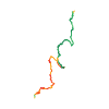
Ski tour · Kanton Bern. The published line is 18.2 km long.
Map layers
Take the route with you
Download GPX ↓Original route geometry with estimated elevations from our terrain model. No account or app required.
ODbL 1.0 + CC BY-SA 3.0 FR · Licence. Source credits are included in the file.
- Highest point
- ≈ 2,689 m
Source summary
Traversée offrant une belle vue dégagée. Peu de difficultés excepté les 200 derniers mètres plus raides et le couloir qui surplombe le Wintertäli, si on choisit cette option.
Source directions
* Ascension depuis le Kandertal
Depuis l'arrêt de bus "Mitholz, Underem Büel", revenir sur le tunnel routier et prendre vers l'E la route/chemin jusqu'à l'alpage de Giesene et poursuivre jusqu'à Voregg.
On gagne l'épaule NO de l‘Ärmighorn soit en faisant un grand arc de cercle en direction du Sattelhorn, soit en franchissant la barre rocheuse par un couloir en contrebas du point 2363.
Pente douce jusqu'à 2550 m. On remonte alors une pente raide sur 100 m pour rejoindre la base du sommet.
Contourner la paroi par la droite jusqu'à l'arête. Puis petite escalade facile (II, un gros point bleu indique où passer) pour gravir le bastion sommital.
* Descente vers Kiental. Deux options : à gauche ou à droite de la Bachflue.
À gauche (W) pour rejoindre le télésiège de Ramslauenen via le vallon qui s‘évase progressivement.
À droite (Est) pour rejoindre Gumpelmad via le Wintertäli (passage clef à 1960 m, court passage raide, 30 m à 45°). Suivre ensuite la route jusqu'à Kiental (itinéraire obligatoire, site de protection de la faune).
Source safety information
La large épaule NO de l’Ärmighorn est généralement soufflée.
Dépôt des skis selon les conditions entre 2550 m (pied des difficultés) et 2700 m (bastion sommital).
The map shows the published line. Provider ascent and descent retain their original meaning; estimates along the line are marked ≈. An additional return route is not automatically included in the line. Elevation profile estimated from Copernicus DEM. Provider statistics may differ.
Weather · next 48 hours
Loading weather …
BULLETIN
Avalanche bulletins along this route
Bulletin regions along this line: Kandersteg
Regional avalanche bulletins do not assess an individual route. Check validity, elevation and aspect.
NATUR · NATURE
Protected areas along the route
Chüewengleni
Bundesinventar der Trockenwiesen und -weiden von nationaler Bedeutung
Kartendarstellung vereinfacht; maßgeblich ist die verlinkte Originalquelle.
Kiental
Bundesinventar der eidgenössischen Jagdbanngebiete
Kartendarstellung vereinfacht; maßgeblich ist die verlinkte Originalquelle.
Gürmschi
Bundesinventar der Trockenwiesen und -weiden von nationaler Bedeutung
Kartendarstellung vereinfacht; maßgeblich ist die verlinkte Originalquelle.
Open on your iPhone · QR
Source & data
Camptocamp · Mat'hieu, botopo · https://www.camptocamp.org/routes/1397166 · Coordinates reprojected; DEM elevation estimates · ODbL 1.0 + CC BY-SA 3.0 FR
Camptocamp · 2022-03-13T13:37:09.623566+00:00
Produced using Copernicus WorldDEM-30 © DLR e.V. 2010-2014 and © Airbus Defence and Space GmbH 2014-2018 provided under COPERNICUS by the European Union and ESA; all rights reserved.
Tour-ID: c2c:route/1397166 · Revision: 5344a1811b40