
GeoSphere Austria · sources
Ski tours · Kanton Wallis
Aiguilles d'Arpette - Creux Magnin (point 2614 m) · Versant NW
Elevation profile
Snow depth
Model · 1 kmLoading snow model …
- Distance
- 6.8 km
- Ascent
- 1,120 m
- Descent from source
- 1,120 m
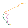
Ski tour · Kanton Wallis. The published line is 6.8 km long.
Map layers
Take the route with you
Download GPX ↓Original route geometry with estimated elevations from our terrain model. No account or app required.
ODbL 1.0 + CC BY-SA 3.0 FR · Licence. Source credits are included in the file.
- Highest point
- ≈ 2,630 m
Source directions
[img=205419 right]Creux Magnin point 2614 m (Val d'Arpette)[/img]
##Montée
Atteindre l'Arpette en prenant la route forestière par le Borloz afin d'éviter de remonter la piste de ski de la Breya à contre-sens. Poursuivre dans le fond du Val d'Arpette jusqu'au point 1822 m. De ce point, prendre plein S par une pente se raidissant jusqu'à 2200 m. Ensuite la pente s'adoucit pour atteindre Creux Magnin proprement dit. Du plat de Creux Magnin, prendre la direction du point coté 2614 m correspondant à un col donnant sur le val d'Orny. La pente NW (100 m environ) est assez raide, 40° par endroits, sans être exposée.
###Variante
Il est possible depuis le plat de Creux Magnin (2500 m) de remonter un couloir assez raide au SW (à l'E du point sur l'arête coté 2879 m). La pente au sommet approche les 45° (S4). Couloir assez étroit mais peu exposé. De plus, vu son orientation, il est presque toujours en neige poudreuse.
##Descente
Par le même itinéraire.
Source safety information
- Fond du Val d'Arpette, plat.
- Attention, la première partie de la montée à partir du pt 1822 m s'effectue sous les couloirs d'avalanches de la Tête d'Arpette.
- Risque de plaques dans la dernière pente.
The map shows the published line. Provider ascent and descent retain their original meaning; estimates along the line are marked ≈. An additional return route is not automatically included in the line. Elevation profile estimated from Copernicus DEM. Provider statistics may differ.
Weather · next 48 hours
Loading weather …
BULLETIN
Avalanche bulletins along this route
Bulletin regions along this line: Génépi, Val d'Entremont - Val Ferret
Regional avalanche bulletins do not assess an individual route. Check validity, elevation and aspect.
NATUR · NATURE
Protected areas along the route
Marais Val d'Arpette
Private Naturschutzgebiete
Kartendarstellung vereinfacht; maßgeblich ist die verlinkte Originalquelle.
Open on your iPhone · QR
Source & data
Camptocamp · Céline Stern-Kiener, Christian, alexduchablais, Evi, Borut, rabot, botopo · https://www.camptocamp.org/routes/204612 · Coordinates reprojected; DEM elevation estimates · ODbL 1.0 + CC BY-SA 3.0 FR
Camptocamp · 2020-02-07T08:15:05.216791+00:00
Produced using Copernicus WorldDEM-30 © DLR e.V. 2010-2014 and © Airbus Defence and Space GmbH 2014-2018 provided under COPERNICUS by the European Union and ESA; all rights reserved.
Tour-ID: c2c:route/204612 · Revision: 1b47c37bddef