
GeoSphere Austria · sources
Elevation profile
Snow depth
Model · 1 kmLoading snow model …
- Distance
- 4.1 km
- Ascent
- 573 m
- Descent from source
- 528 m
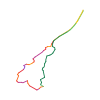
Ski tour · Kanton Wallis. The published line is 4.1 km long.
Map layers
Take the route with you
Download GPX ↓Original route geometry with estimated elevations from our terrain model. No account or app required.
ODbL 1.0 + CC BY-SA 3.0 FR · Licence. Source credits are included in the file.
- Highest point
- ≈ 3,996 m
Source directions
[img=421643 right]Allallinhorn N Wand[/img]
##Aufstieg
Über die normalroute ca.2std ohne nennenswerte schwierigkeiten.
Es kann auch über den nordostgrad aufgestiegen werden (häufig vereist !).
##Abfahrt
Über die nordostseite: empfehlen den einstig auf höhe des Gipfelkreuzes -was die absturzgefahr verringert. Linkshaltend zu einer grossen Wächte abfahren.
Es empfielt sich die Wächte links zu umfahren (vorsicht vor dem Gletscherabruch !).
Anschliessend Abfahrt nach Saas Fee.
Source safety information
* Einer der leichtesten viertausender über die normalroute.
* Abfahrt über nordostseite nur bei absolut sicheren verhältnissen.
* Nordosthang mit gletscherabbrüchen.
* Grösstes Gefälle ca. 100m 52°
* Sehr ausgesetzter Gipfelhang.
* Die Tour sollte nur bei idealen Schneeverhältnissen unternommen werden.
* Der Hang ist im Sommer sehr nassschneerutsch gefährdet.
Source equipment information
* Eispickel, Seil und bei Aufstieg über die Nordseite steigeisen.
Source directions
[img=421643 right]Allallinhorn parete N[/img]
##Salita
Dalla stazione del Mittelallalin 3454m seguire in piano verso SE le piste battute sino a raggiungere l’arrivo degli skilift. Procedere sul ripidissimo dosso nevoso (i primi 100m a 40°/45° poi un po' più appoggiato) e, oltrepassata una breve crestina di fianco ad un grosso seracco, raggiungere il ripiano a quota 3900m circa sotto la ripidissima paretina finale.
Superare la terminale al centro o verso destra, in funzione delle condizioni, e salire direttamente alla croce di vetta (100m a 50°).
##Discesa
Per il medesimo itinerario. Con ottime condizioni, dal ripiano a quota 3900m. è possibile scendere direttamente verso NE sulle piste battute. Proseguire lungo il Feegletscher seguendo più o meno fedelmente le piste battute sino alla stazione del Felskinn 2990m. o se l’innevamento lo permette sino alla stazione intermedia di Morenia 2465m o Sass Fee paese 1803m.
Source safety information
* Bell’itinerario di sci ripido, in ambiente stupendo nonostante la vicinanza agli impianti di risalita.
Source directions
[img=421643 right]Allallinhorn face N[/img]
##Montée
De la gare du métro rejoindre le haut du téléski par les pistes (20-30min) puis prendre l'arête NE. Assez raide au-début, la pente s'adoucit entre 3650 m et 3850 m, jusqu'au passage d'un petit sérac pour accéder au replat vers 3850 m -3900m. Traverser le replat légèrement vers la gauche jusqu'à une petite rimaye/crevasse, vers 3920 m, l'aplomb du sommet se trouve environ à un tiers de la largeur de la face, à gauche, puis monter droit dans la face sommitale (45-50° sur 100 m).
À ski
Si l'objectif est la descente à ski, il est également possible de monter par la voie normale du Feejoch et le versant SW, même s'il est préférable de repérer la face N à la montée.
##Descente
À pied
Par la voie normale.
À ski
Par la face, même itinéraire qu'à la montée, puis suivre les pistes, prendre le glacier pour rejoindre sous Felskinn.
Source safety information
- Montée très efficace
- Assez exposé sur l'arête.
- Orientation plein N pour la face
The map shows the published line. Provider ascent and descent retain their original meaning; estimates along the line are marked ≈. An additional return route is not automatically included in the line. Elevation profile estimated from Copernicus DEM. Provider statistics may differ.
Weather · next 48 hours
Loading weather …
BULLETIN
Avalanche bulletins along this route
Bulletin regions along this line: Saas Fee
Regional avalanche bulletins do not assess an individual route. Check validity, elevation and aspect.
NATUR · NATURE
Protected areas along the route
No protected area was found along this line in the available dataset. Follow local notices.
Open on your iPhone · QR
Source & data
Camptocamp · Camptocamp-Association, Céline Stern-Kiener, Christian, alexduchablais, José Picheral, Mamo Comotti, Yuki, Alberto Grassi, rabot, botopo · https://www.camptocamp.org/routes/45564 · Coordinates reprojected; DEM elevation estimates · ODbL 1.0 + CC BY-SA 3.0 FR
Camptocamp · 2018-12-21T05:35:36.458193+00:00
Produced using Copernicus WorldDEM-30 © DLR e.V. 2010-2014 and © Airbus Defence and Space GmbH 2014-2018 provided under COPERNICUS by the European Union and ESA; all rights reserved.
Tour-ID: c2c:route/45564 · Revision: 059aec9f1f05