
GeoSphere Austria · sources
Elevation profile
Snow depth
Model · 1 kmLoading snow model …
- Distance
- 19.8 km
- Ascent
- 2,130 m
- Descent from source
- 2,130 m
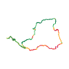
Ski tour · Kanton Wallis. The published line is 19.8 km long.
Map layers
Take the route with you
Download GPX ↓Original route geometry with estimated elevations from our terrain model. No account or app required.
ODbL 1.0 + CC BY-SA 3.0 FR · Licence. Source credits are included in the file.
- Highest point
- ≈ 4,170 m
Source directions
## Montée
Täschalp - Täschhütte - Alphubeljoch - Alphubel sommet N (détour possible par la croix sommitale env. 15min de plus)
## Descente
Du pt 4125 m, descendre au mieux le long de l'arête N en visant le Mischabeljochbiwak. Par manque de neige faire un crochet sur la droite à l'altitude 4000 m, revenir sur l'arête au plus tard à l'alt. 3890 m pour basculer sur le versant du Weingartengletscher, passer dessous le Mischabeljochbiwak et descendre ce glacier, d'abord dans son centre jusqu'à 3500 m, ensuite sur la gauche dans le sens descente, passer à l'E du Weingartensee, ensuite remonter 50 m pour rejoindre le vallon du Tälli et suivre un joli sentier qui ramène à la Täschhütte et Taschalp.
Source safety information
* Peut être effectué sur 2 jours en dormant à la Täschhütte.
* La montée à Täschhütte se fait facilement en ebike.
* Le Weingartengletscher est très crevassé.
* Par fort enneigement possibilité de descendre la face jusqu'au goulet alt. 3800 m, dans ce cas il faudra soit remonter 50 m jusqu'au Mischabeljoch ou descendre le très tourmenté Feegletscher jusqu'à Langfluh.
The map shows the published line. Provider ascent and descent retain their original meaning; estimates along the line are marked ≈. An additional return route is not automatically included in the line. Elevation profile estimated from Copernicus DEM. Provider statistics may differ.
Weather · next 48 hours
Loading weather …
BULLETIN
Avalanche bulletins along this route
Bulletin regions along this line: Zermatt, Saas Fee
Regional avalanche bulletins do not assess an individual route. Check validity, elevation and aspect.
NATUR · NATURE
Protected areas along the route
No protected area was found along this line in the available dataset. Follow local notices.
Open on your iPhone · QR
Source & data
Camptocamp · Pierre-Alain Wenger, julien Burnod, Borut, botopo, CaBot · https://www.camptocamp.org/routes/1421227 · Coordinates reprojected; DEM elevation estimates · ODbL 1.0 + CC BY-SA 3.0 FR
Camptocamp · 2024-10-18T19:12:50.027147+00:00
Produced using Copernicus WorldDEM-30 © DLR e.V. 2010-2014 and © Airbus Defence and Space GmbH 2014-2018 provided under COPERNICUS by the European Union and ESA; all rights reserved.
Tour-ID: c2c:route/1421227 · Revision: 10d76da9c9aa