
GeoSphere Austria · sources
Elevation profile
Snow depth
Model · 1 kmLoading snow model …
- Distance
- 12.6 km
- Ascent
- 1,250 m
- Descent from source
- 1,250 m
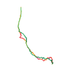
Ski tour · Département Hautes-Alpes. The published line is 12.6 km long.
Map layers
Take the route with you
Download GPX ↓Original route geometry with estimated elevations from our terrain model. No account or app required.
ODbL 1.0 + CC BY-SA 3.0 FR · Licence. Source credits are included in the file.
- Highest point
- ≈ 2,898 m
Source directions
Du parking Prébois de la station des Orres, suivre la piste forestière assez plate sur 2 km jusqu'au point 1776 m. Remonter le vallon de l'Eissalete par le chemin d'été jusqu'au Cabane du Lac. Traverser le grand replat en direction SE pour rejoindre le point 2278 m. Remonter la combe W permettant de gagner le col 2795 m au N du sommet puis une croupe N se redressant dans les derniers 50 m (court S3/S4).
Descente identique à la montée.
On peut aussi descendre le couloir NW (4.1), débutant légèrement au SW du sommet pour rejoindre la combe W.
The map shows the published line. Provider ascent and descent retain their original meaning; estimates along the line are marked ≈. An additional return route is not automatically included in the line. Elevation profile estimated from Copernicus DEM. Provider statistics may differ.
Weather · next 48 hours
Loading weather …
BULLETIN
Avalanche bulletins along this route
No EUREGIO bulletin region is assigned to this line.
Check the official report for current danger and validity. Avalanche warning services
Regional avalanche bulletins do not assess an individual route. Check validity, elevation and aspect.
NATUR · NATURE
Protected areas along the route
No protected area was found along this line in the available dataset. Follow local notices.
Open on your iPhone · QR
Source & data
Camptocamp · Camptocamp-Association, José Picheral, Antoine Marnat, rabot, botopo · https://www.camptocamp.org/routes/48444 · Coordinates reprojected; DEM elevation estimates · ODbL 1.0 + CC BY-SA 3.0 FR
Camptocamp · 2025-05-06T22:45:15.744767+00:00
Produced using Copernicus WorldDEM-30 © DLR e.V. 2010-2014 and © Airbus Defence and Space GmbH 2014-2018 provided under COPERNICUS by the European Union and ESA; all rights reserved.
Tour-ID: c2c:route/48444 · Revision: d0aacf57c9f3