
GeoSphere Austria · sources
Elevation profile
Snow depth
Model · 1 kmLoading snow model …
- Distance
- 5.5 km
- Ascent
- 1,373 m
- Descent from source
- 3 m
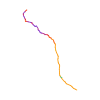
Ski tour · Kanton Uri. The published line is 5.5 km long.
Map layers
Take the route with you
Download GPX ↓Original route geometry with estimated elevations from our terrain model. No account or app required.
ODbL 1.0 + CC BY-SA 3.0 FR · Licence. Source credits are included in the file.
- Highest point
- ≈ 2,847 m
Source directions
## Salita
Seguire la strada del Sustenpass fino a q.1613 in prossimità di un ponte dove la strada compie una curva verso sinistra e dove peraltro vi è un cartello indicante la Sewenhuette, inoltrarsi nella valle di Chlialp in direzione N. Dopo aver superato normalmente parecchi resti di valanga provenienti dai pendii sovrastanti il Sewenstock giungere alla fine della valle - Wyssgand.
Sulla sinistra si vede l'imbocco del canale, con pendenze dai 35° ai 45° che, sopratutto nella parte iniziale, è pericoloso per via delle possibili scariche dalle pareti circostanti e richiede condizioni ipersicure!
Il canale, con sotto un torrente!!, ha due punti dove con poca neve può diventare difficoltoso il passaggio.
Arrivati a q 2461. si segue il bellissimo vallone a sx fino poco sotto una cresta, dove si devia a NE e si sale un ripido canale a 45°; sbucati si vede la cima che si raggiunge in pochi minuti per una facile cresta con forte esposizione.
## Discesa
Per l'itinerario di salita.
The map shows the published line. Provider ascent and descent retain their original meaning; estimates along the line are marked ≈. An additional return route is not automatically included in the line. Elevation profile estimated from Copernicus DEM. Provider statistics may differ.
Weather · next 48 hours
Loading weather …
BULLETIN
Avalanche bulletins along this route
Bulletin regions along this line: Meiental
Regional avalanche bulletins do not assess an individual route. Check validity, elevation and aspect.
NATUR · NATURE
Protected areas along the route
Altboden
Bundesinventar der Auengebiete von nationaler Bedeutung
Kartendarstellung vereinfacht; maßgeblich ist die verlinkte Originalquelle.
Open on your iPhone · QR
Source & data
Camptocamp · Céline Stern-Kiener, cimaxi, Arno Ladstaetter · https://www.camptocamp.org/routes/707296 · Coordinates reprojected; DEM elevation estimates · ODbL 1.0 + CC BY-SA 3.0 FR
Camptocamp · 2016-02-09T13:57:39.787597+00:00
Produced using Copernicus WorldDEM-30 © DLR e.V. 2010-2014 and © Airbus Defence and Space GmbH 2014-2018 provided under COPERNICUS by the European Union and ESA; all rights reserved.
Tour-ID: c2c:route/707296 · Revision: 013cbdd3ee01