
GeoSphere Austria · sources
Elevation profile
Snow depth
Model · 1 kmLoading snow model …
- Distance
- 11.7 km
- Ascent
- 650 m
- Descent from source
- 650 m
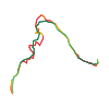
Ski tour · Kanton Wallis. The published line is 11.7 km long.
Map layers
Take the route with you
Download GPX ↓Original route geometry with estimated elevations from our terrain model. No account or app required.
ODbL 1.0 + CC BY-SA 3.0 FR · Licence. Source credits are included in the file.
- Highest point
- ≈ 1,986 m
Source summary
Itinéraire facile mais assez skiant car la forêt n'est pas trop dense. Malgré la proximité des remontées mécaniques (sur l'autre versant), ce parcours est assez sauvage.
Source directions
[img=146364 right]Pour l'itinéraire, cherchez les points rouges[/img]
##Montée
Du Pas de Morgins, suivre la route versant français et prendre à droite une piste d'alpage démarrant près d'un réservoir d'eau. Suivre la piste jusqu'au chalet de Sur le Bord et continuer en direction de la Mouille. Quand le chemin amorce une descente, le quitter à droite et remonter des sous-bois clairsemés jusqu'au Roc du Cheval (Cheval Blanc sur CNS) et suivre l'arête (parfois un peu en contrebas sur le flanc W) jusqu'au sommet du Bec du Corbeau.
##Descente
Par le même itinéraire. Il est probablement possible de couper à plusieurs endroits, la forêt n'étant pas trop dense dans ce secteur.
Source safety information
- Ça skie bien tout du long, il y a beaucoup de possibilités pour couper.
- L'itinéraire est balisé avec des panneaux "sentier hiver" (raquettes) jusque vers Sur le Bord. À partir du Roc du Cheval, on trouve des balises "chemin pédestre".
The map shows the published line. Provider ascent and descent retain their original meaning; estimates along the line are marked ≈. An additional return route is not automatically included in the line. Elevation profile estimated from Copernicus DEM. Provider statistics may differ.
Weather · next 48 hours
Loading weather …
BULLETIN
Avalanche bulletins along this route
Bulletin regions along this line: Vouvry, Monthey - Val d'Illiez
Regional avalanche bulletins do not assess an individual route. Check validity, elevation and aspect.
NATUR · NATURE
Protected areas along the route
No protected area was found along this line in the available dataset. Follow local notices.
Open on your iPhone · QR
Source & data
Camptocamp · Christian, Frédéric Bunoz, alexduchablais, David Bochot, botopo · https://www.camptocamp.org/routes/146361 · Coordinates reprojected; DEM elevation estimates · ODbL 1.0 + CC BY-SA 3.0 FR
Camptocamp · 2018-09-01T08:07:26.483372+00:00
Produced using Copernicus WorldDEM-30 © DLR e.V. 2010-2014 and © Airbus Defence and Space GmbH 2014-2018 provided under COPERNICUS by the European Union and ESA; all rights reserved.
Tour-ID: c2c:route/146361 · Revision: be7384f9086e