
GeoSphere Austria · sources
Elevation profile
Snow depth
Model · 1 kmLoading snow model …
- Distance
- 10.5 km
- Ascent
- 1,229 m
- Descent from source
- 1,229 m
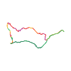
Ski tour · Kanton Wallis. The published line is 10.5 km long.
Map layers
Take the route with you
Download GPX ↓Original route geometry with estimated elevations from our terrain model. No account or app required.
ODbL 1.0 + CC BY-SA 3.0 FR · Licence. Source credits are included in the file.
- Highest point
- ≈ 2,636 m
Source directions
[img=194635 right]Bel Oiseau versant N et E[/img]
##Montée
Prendre le chemin d'alpage en direction de Fenestral (1797 m), puis gagner Le Plan des Marais. Continuer à gauche par de larges pentes. Sortir à droite et gagner le Col du Bel Oiseau. Rejoindre le sommet par le flanc W.
##Descente
Longer l'arête SSE. Prendre le couloir qui se trouve vers le col ( sans nom) entre le Bel Oiseau et le sommet à 2643 m. Descendre jusqu'à l'entonnoir, contourner les rochers inférieurs sur la droite et descendre de larges pentes jusqu'à un replat (Lué de Balayé). Descendre directement jusqu'à la route d'Émosson. Celle-ci conduit à Finhaut.
Source safety information
- Le sommet ne se trouve pas à 2643 m. Le Bel Oiseau est le sommet suivant qui est à 2628,1m.
- Si la route est fermée à Finhaut, compter 120 m de plus.
- 200 m à 42° de moyenne (sur CNS)
- L'itinéraire de montée est peu exposé au soleil -> poudreuse
The map shows the published line. Provider ascent and descent retain their original meaning; estimates along the line are marked ≈. An additional return route is not automatically included in the line. Elevation profile estimated from Copernicus DEM. Provider statistics may differ.
Weather · next 48 hours
Loading weather …
BULLETIN
Avalanche bulletins along this route
Bulletin regions along this line: Emosson
Regional avalanche bulletins do not assess an individual route. Check validity, elevation and aspect.
NATUR · NATURE
Protected areas along the route
No protected area was found along this line in the available dataset. Follow local notices.
Open on your iPhone · QR
Source & data
Camptocamp · Camptocamp-Association, Christian, alexduchablais, steven, Evi, David Bochot, Compte Modération Topoguide, sylvain brondex, tvmountain, rabot, botopo · https://www.camptocamp.org/routes/45865 · Coordinates reprojected; DEM elevation estimates · ODbL 1.0 + CC BY-SA 3.0 FR
Camptocamp · 2024-02-29T14:57:34.803791+00:00
Produced using Copernicus WorldDEM-30 © DLR e.V. 2010-2014 and © Airbus Defence and Space GmbH 2014-2018 provided under COPERNICUS by the European Union and ESA; all rights reserved.
Tour-ID: c2c:route/45865 · Revision: 26a188b28491