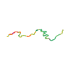
Surface from sourceAsphalt · Gravel · Other surface · Path · Road
Distance from source20.0 km
Lowest elevation from source509 m
Highest elevation from source1,536 m
Notices in the source snapshot
These notices come from the stored source snapshot. They do not establish a current closure. Check the source website for current information.
Sperre Forststraße Klausmoos
Aufgrund einer Holzernte ist die Forstraße Klausmoos in Hallstatt vom 18.09.2026 bis voraussichtlich 08.10.2026 gesperrt. Eine Umleitung ist nicht möglich. 47.5553033788698, 13.60340540039184
Begins according to source2026-09-18
Ends according to source2026-10-08
Diversion from source
Eine Umleitung ist nicht möglich
The map shows the published line. Provider ascent and descent retain their original meaning; estimates along the line are marked ≈. An additional return route is not automatically included in the line. Elevation profile estimated from Copernicus DEM. Provider statistics may differ.
Weather · next 48 hours
Loading weather …
BULLETIN
Avalanche bulletins along this route
No EUREGIO bulletin region is assigned to this line.