← Back to the map

Hiking · Steiermark

Bosruck - Grenzberg mit drei Gipfelkreuzen (Westgrat)

Elevation profile

Explore the elevation profile
9471,4531,9580 km5.2 kmm
Distance
5.2 km
Ascent
1,038 m
Descent from source
55 m

Hike · Steiermark. The published line is 5.2 km long.

Route outline
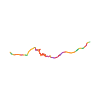
Route outline without a basemap
Map layers

Take the route with you

Download GPX ↓

Original route geometry with estimated elevations from our terrain model. No account or app required.

CC BY 4.0 · Licence. Source credits are included in the file.

Highest point
≈ 1,958 m
Duration from source
4 h 10 min
Source difficulty—
Season from source
Jun, Jul, Aug, Sep, Oct, Nov
Start from source4582 Spital am Pyhrn
Finish from source4582 Spital am Pyhrn
Route number from source610, 611
Seasons from sourceAutumn · Summer
Website from sourceOpen website ↗
Surface from sourceGravel · Trail
Distance from source5.2 km
Lowest elevation from source959 m
Highest elevation from source1,947 m

Notices in the source snapshot

These notices come from the stored source snapshot. They do not establish a current closure. Check the source website for current information.

Sprengarbeiten beim Gipsbergbau „Fuchsalm“

Die vor Ort angebrachte Hinweistafel „Vorsicht Sprengarbeiten“ sind grundsätzlich erst dann als aktuell anzusehen, wenn dort auch konkrete Sprengzeiten bzw. entsprechende Hinweise angezeigt werden.

Die Dauer der eigentlichen Sprengarbeiten bzw. der damit verbundenen vollständigen Sperre beträgt ca. 15 Minuten. Unmittelbar nach erfolgter Sprengung und entsprechender Freigabe werden die betroffenen Wanderwege wieder geöffnet und können wieder uneingeschränkt benützt werden.

The map shows the published line. Provider ascent and descent retain their original meaning; estimates along the line are marked ≈. An additional return route is not automatically included in the line. Elevation profile estimated from Copernicus DEM. Provider statistics may differ.

Weather · next 48 hours

Loading weather …

BULLETIN

Avalanche bulletins along this route

No EUREGIO bulletin region is assigned to this line.

Check the official report for current danger and validity. Avalanche warning services

Regional avalanche bulletins do not assess an individual route. Check validity, elevation and aspect.

NATUR · NATURE

Protected areas along the route

Bosruck (A6) - Totes Gebirge

Naturschutzgebiet

European Environment Agency (EEA) · CC BY 4.0

Kartendarstellung vereinfacht; maßgeblich ist die verlinkte Originalquelle.

Ennstaler und Eisenerzer Alpen

Landschaftsschutzgebiet

European Environment Agency (EEA) · CC BY 4.0

Kartendarstellung vereinfacht; maßgeblich ist die verlinkte Originalquelle.

IPHONE · ANDROID · WATCH

Maps and recording on your phone and watch.

Take your route offline. For iPhone, Android, Apple Watch and Wear OS.

Open in Hanglage ↗
Source & data

Data sources & safety

CC-BY-4.0: Österreich Werbung · CC BY 4.0

Österreich Werbung · 2026-08-24T16:35:01+02:00

Produced using Copernicus WorldDEM-30 © DLR e.V. 2010-2014 and © Airbus Defence and Space GmbH 2014-2018 provided under COPERNICUS by the European Union and ESA; all rights reserved.

Tour-ID: oew:tourdata_tour_430001009 · Revision: 9dea28a09c95