
GeoSphere Austria · sources
Elevation profile
Snow depth
Model · 1 kmLoading snow model …
- Distance
- 11.1 km
- Ascent
- 878 m
- Descent from source
- 878 m
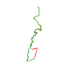
Ski tour · Bayern. The published line is 11.1 km long.
Map layers
Take the route with you
Download GPX ↓Original route geometry with estimated elevations from our terrain model. No account or app required.
ODbL 1.0 + CC BY-SA 3.0 FR · Licence. Source credits are included in the file.
- Highest point
- ≈ 1,656 m
Source directions
From the BOB train station, follow the Brecherspitz hiking trail.
The trail goes in the forest for a while and then comes out on a flat part where 3 huts are located.
The tour goes along the ridge of Brecherspitz on the E side. You might need to remove the skis to get to the top.
the view from the Brecherspitz is very nice and you can see 'flat germany' on one side to the N and magnificent alps to the S.
The tour continues along the ridge to an anteanna base station where a relatively steep slope leads you back to the huts.
Source safety information
You can reach Neuhaus from Munich using the BOB train. Stop at Fischhausen/Neuhaus.
Follow the hiking sign to the Brecherspitz.
For german readers: http://www.outdooractive.com/de/skitour/bayern/von-neuhaus-auf-den-brecherspitz/-8182572280335247448/
The map shows the published line. Provider ascent and descent retain their original meaning; estimates along the line are marked ≈. An additional return route is not automatically included in the line. Elevation profile estimated from Copernicus DEM. Provider statistics may differ.
Weather · next 48 hours
Loading weather …
BULLETIN
Avalanche bulletins along this route
Bulletin regions along this line: Bavarian Prealps Central
Check the official report for current danger and validity. Avalanche warning services
A Bavarian danger level is shown only with a valid bulletin. Lawinenwarndienst Bayern
Regional avalanche bulletins do not assess an individual route. Check validity, elevation and aspect.
NATUR · NATURE
Protected areas along the route
Schutz des Spitzingsees und seiner Umgebung
Landschaftsschutzgebiet
Abfall entsorgen
Abfall entsorgen ist verboten.
Nutzung von Schwimmhilfe (Surfbretter, Luftmatratze)
Nutzung von Schwimmhilfe (Surfbretter, Luftmatratze) ist in ausgewiesenen Bereichen verboten. Es ist verboten, den Spitzingsee mit Segelsurfern zu befahren.
Wasserfahrzeuge (ohne Motor)
Wasserfahrzeuge (ohne Motor) sind in ausgewiesenen Bereichen verboten. Für Fahrzeuge ohne Eigenantrieb (einschließlich Schlauchboote, Luftmatratzen u. ä.) ist es verboten, sich dem westlichen Ufer oder den Ried- und Röhrichtzonen zu nähern, am westlichen Ufer anzulegen oder von dort Fahrzeuge einzubringen.
Zelten
Zelten ist nur auf ausgewiesenen Plätzen erlaubt.
Digitize the Planet · CC0 1.0 · Hinweise
Bundesamt für Naturschutz · GeoNutzV
Verordnung zum Schutze des Spitzingsees und seiner Umgebung ·
Verordnung über die Regelung des Gemeingebrauchs auf dem Spitzingsee ·
Kartendarstellung vereinfacht; maßgeblich ist die verlinkte Originalquelle.
Schutz des Schliersees und seiner Umgebung
Landschaftsschutzgebiet
Betreten des Gebietes
Betreten des Gebietes ist auf ausgewiesenen Wegen vom 1. April bis zum 30. September verboten. Betrifft das Fischlaichschongebiet am Kurpark Schliersee
Abfall entsorgen
Abfall entsorgen ist verboten.
Zelten
Zelten ist nur auf ausgewiesenen Plätzen erlaubt.
Digitize the Planet · CC0 1.0 · Hinweise
Bundesamt für Naturschutz · GeoNutzV
Kartendarstellung vereinfacht; maßgeblich ist die verlinkte Originalquelle.
Open on your iPhone · QR
Source & data
Camptocamp · L. Besson, Nicolas Chevillot, CaBot · https://www.camptocamp.org/routes/250762 · Coordinates reprojected; DEM elevation estimates · ODbL 1.0 + CC BY-SA 3.0 FR
Camptocamp · 2018-06-07T14:15:42.459245+00:00
Produced using Copernicus WorldDEM-30 © DLR e.V. 2010-2014 and © Airbus Defence and Space GmbH 2014-2018 provided under COPERNICUS by the European Union and ESA; all rights reserved.
Tour-ID: c2c:route/250762 · Revision: 201174bc2fed