
GeoSphere Austria · sources
Elevation profile
Snow depth
Model · 1 kmLoading snow model …
- Distance
- 8.2 km
- Ascent
- 1,230 m
- Descent from source
- 1,230 m
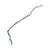
Ski tour · Kanton Wallis. The published line is 8.2 km long.
Map layers
Take the route with you
Download GPX ↓Original route geometry with estimated elevations from our terrain model. No account or app required.
ODbL 1.0 + CC BY-SA 3.0 FR · Licence. Source credits are included in the file.
- Highest point
- ≈ 2,831 m
Source summary
Itinerario che si scopre mano a mano che si sale, l’ambiente è molto suggestivo e gli spazi sono decisamente ampi. L’ideale per fare dei gran curvoni
Source directions
[img=517843 right/]
## Salita
Da Egga, falegnameria, salire il vallone di Rossbode, proseguire per la conca di Breits Loib una volta giunti al ripiano di quota 2148 m imboccare il canalone che si apre sul versante N del Breitloibgrat.
Salire tagliando in obliquo la parete sino a raggiungere un’ampio e panoramico plateau, proseguire dritto per circa 200 m. e percorrere un ripido canale sulla sinistra, uscita delicata roccette, raggiungere quindi la cresta percorrendo la pala finale.
## Discesa
Per l'itinerario di salita.
Source equipment information
Ramponi, pica e casco
The map shows the published line. Provider ascent and descent retain their original meaning; estimates along the line are marked ≈. An additional return route is not automatically included in the line. Elevation profile estimated from Copernicus DEM. Provider statistics may differ.
Weather · next 48 hours
Loading weather …
BULLETIN
Avalanche bulletins along this route
Bulletin regions along this line: Southern Simplon region
Regional avalanche bulletins do not assess an individual route. Check validity, elevation and aspect.
NATUR · NATURE
Protected areas along the route
No protected area was found along this line in the available dataset. Follow local notices.
Open on your iPhone · QR
Source & data
Camptocamp · Céline Stern-Kiener, José Picheral, Alberto Grassi, L. Besson, JeanPhi Fontaine, botopo · https://www.camptocamp.org/routes/517808 · Coordinates reprojected; DEM elevation estimates · ODbL 1.0 + CC BY-SA 3.0 FR
Camptocamp · 2018-07-29T10:22:39.461955+00:00
Produced using Copernicus WorldDEM-30 © DLR e.V. 2010-2014 and © Airbus Defence and Space GmbH 2014-2018 provided under COPERNICUS by the European Union and ESA; all rights reserved.
Tour-ID: c2c:route/517808 · Revision: d7aa04cd6b1c