
GeoSphere Austria · sources
Elevation profile
Snow depth
Model · 1 kmLoading snow model …
- Distance
- 5.8 km
- Ascent
- 1,520 m
- Descent from source
- 1,520 m
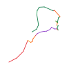
Ski tour · Alpes-Maritimes. The published line is 5.8 km long.
Map layers
Take the route with you
Download GPX ↓Original route geometry with estimated elevations from our terrain model. No account or app required.
ODbL 1.0 + CC BY-SA 3.0 FR · Licence. Source credits are included in the file.
- Highest point
- ≈ 2,710 m
Source summary
Couloir démarrant au NE de la Baisse du Pélago, vers 2680 m, et débouchant dans le Vallon des Cayres Nègres 2500.
Source directions
[img=1869526 right]couloir le plus à g.[/img]
[img=1870933 right]couloir le plus à g.[/img]
[img=1870958 right]de l'antécime 2750, l'entrée est à droite[/img]
## Aller-retour
Du Boréon prendre le sentier de Cougourde puis le vallon Sangué, puis main gauche au point 2282 le Vallon des Cayres Nègres. À 2500, le couloir est à main gauche.
## En boucle
Du pied du vallon des Erps, suivre l'itinéraire du [[routes/57379|Couloir Nathalie]] (g ou d) 'jusqu'en haut' à l'antécime 2750 (+1250).
Descendre plein N les larges pentes jusqu'au replat 2610. Repeauter et monter N vers la baisse du Pélago puis en écharpe à droite (N) pour contourner une un ressaut rocheux, jusqu'au sommet du triangle de neige 2730 (+120). Descendre en restant au plus à gauche (SE>S) pour trouver l'entrée vers 2680.
Descendre le couloir jusqu'au vallon 2500 (étroit au départ, 45°/200 m, un passage en mixte 50° au milieu, infos et cotations à vérifier!).
Soit descente directe par Sangué (SE).
Soit remonter à la Baisse des Cayres Nègres 2642 (+150) pour descendre un dernier couloir NW (40°/100 m + 35°/100 m) et finir dans le vallon des Erps (S).
The map shows the published line. Provider ascent and descent retain their original meaning; estimates along the line are marked ≈. An additional return route is not automatically included in the line. Elevation profile estimated from Copernicus DEM. Provider statistics may differ.
Weather · next 48 hours
Loading weather …
BULLETIN
Avalanche bulletins along this route
No EUREGIO bulletin region is assigned to this line.
Check the official report for current danger and validity. Avalanche warning services
Regional avalanche bulletins do not assess an individual route. Check validity, elevation and aspect.
NATUR · NATURE
Protected areas along the route
Mercantour [Aire D'Adhésion]
Parc national, aire d'adhésion
Kartendarstellung vereinfacht; maßgeblich ist die verlinkte Originalquelle.
Mercantour
Parc national, zone cœur
Kartendarstellung vereinfacht; maßgeblich ist die verlinkte Originalquelle.
Open on your iPhone · QR
Source & data
Camptocamp · Borut, Antoine Marnat, janic, CaBot, Edward O · https://www.camptocamp.org/routes/1870966 · Coordinates reprojected; DEM elevation estimates · ODbL 1.0 + CC BY-SA 3.0 FR
Camptocamp · 2026-02-10T08:47:02.787245+00:00
Produced using Copernicus WorldDEM-30 © DLR e.V. 2010-2014 and © Airbus Defence and Space GmbH 2014-2018 provided under COPERNICUS by the European Union and ESA; all rights reserved.
Tour-ID: c2c:route/1870966 · Revision: 9ce1aac34be7