
GeoSphere Austria · sources
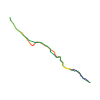
Elevation profile
Snow depth
Model · 1 kmLoading snow model …
- Distance
- 5.8 km
- Ascent
- 855 m
- Descent from source
- 855 m
Ski tour · Kanton Waadt. The published line is 5.8 km long.
Map layers
Take the route with you
Download GPX ↓Original route geometry with estimated elevations from our terrain model. No account or app required.
ODbL 1.0 + CC BY-SA 3.0 FR · Licence. Source credits are included in the file.
- Highest point
- ≈ 2,272 m
Source directions
[img=496679 right/]
##Approche
Depuis les Mosses, rejoindre Lioson d'en Haut, contourner le lac Lioson par la gauche et remonter les pentes à ski sous la goulotte évidente bien visible en dessus du lac pour atteindre le pt 2015. Dépôt de matériel possible.
##Voie
Goulotte en 7 longueurs, relais équipés sur spits reliés avec maillon rapide pour descendre en rappel.
L# | 40 m | |
L# | 50 m | |
L# | 50 m | |
L# | 50 m | |
L# | 40 m | | Le couloir se resserre en L5 pour devenir goulotte (1 spit au début).
L# | 42 m | | 4 spits dans L6 longueur clé avec le passage en mixte.
L# | 25 m | |
La goulotte se termine au col à 2300 m qui se situe au N du Châtillon.
Source safety information
* Approche à ski vivement recommandée.
* Goulotte sympa et surprenante pour les Alpes vaudoises.
* La goulotte peut se skier depuis le milieu de la 5<sup>e</sup> longueur (étroit et pente à 50 degrés).
* Par bon enneigement, les premiers relais sont souvent enfouis sous la neige.
* Par bonnes conditions, il est possible de monter les skis jusqu'en haut et de redescendre une large combe versant E qui rejoint l'itinéraire du Châtillon. Départ direct du col en haut de la goulotte.
Source equipment information
- corde 2×50 m
- quelques dégaines et sangles
- quelques friends variés
- 2-3 broches courtes
- 2 piolets
The map shows the published line. Provider ascent and descent retain their original meaning; estimates along the line are marked ≈. An additional return route is not automatically included in the line. Elevation profile estimated from Copernicus DEM. Provider statistics may differ.
Weather · next 48 hours
Loading weather …
BULLETIN
Avalanche bulletins along this route
Bulletin regions along this line: Pays d'Enhaut, Aigle - Leysin, Bex - Villars
Regional avalanche bulletins do not assess an individual route. Check validity, elevation and aspect.
NATUR · NATURE
Protected areas along the route
No protected area was found along this line in the available dataset. Follow local notices.
Open on your iPhone · QR
Source & data
Camptocamp · Céline Stern-Kiener, alexduchablais, Laurent, Alex Gnaegi, Evi, Philippe Beytrison, TiboCD, rabot, botopo · https://www.camptocamp.org/routes/394017 · Coordinates reprojected; DEM elevation estimates · ODbL 1.0 + CC BY-SA 3.0 FR
Camptocamp · 2021-03-03T15:01:48.664315+00:00
Produced using Copernicus WorldDEM-30 © DLR e.V. 2010-2014 and © Airbus Defence and Space GmbH 2014-2018 provided under COPERNICUS by the European Union and ESA; all rights reserved.
Tour-ID: c2c:route/394017 · Revision: 92fd9682490a