
GeoSphere Austria · sources
Elevation profile
Snow depth
Model · 1 kmLoading snow model …
- Distance
- 15.6 km
- Ascent
- 1,500 m
- Descent from source
- 1,600 m
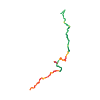
Ski tour · Kanton Waadt. The published line is 15.6 km long.
Map layers
Take the route with you
Download GPX ↓Original route geometry with estimated elevations from our terrain model. No account or app required.
ODbL 1.0 + CC BY-SA 3.0 FR · Licence. Source credits are included in the file.
- Highest point
- ≈ 1,843 m
Source directions
## Ascent 1
From La Tine, pass through meadows NE direction, passing through Petits Crêts, Gros Crêts, La Siète. From this chalet, take the path which leave uphill to Gros Fonds, and go on to L'Arsa Jor. Reach the pass nearby the Culand alpage and then ascend the W ridge of la Chaux de Culand.
## Descent 1
From pass between points 1867m et 1891m, go down the NE slope, direction des Druges, then go on through the orientated NW glade to Les Sauges. Take the path until the junction with road coming from Lessoc (about 1380m).
### Variant
From Les Sauges, go down about 200m more, until the end of Cerniet glade (slopes about 35°-40°), and ascend by the same route to join the road.
## Ascent 2
Follow the path uphill to Fonds, then reach Leity point, and Epaule des Millets.
## Descent 2
By Les Joux and Gros Pas, then follow the road until Grandvillard.
Source safety information
Leavin a car at Granvillard is the best option.
Train or bus approach is not convenient: take the train at Villard sous Mont, change at Montbovon.
Really pleasant traverse which allows to discover the lovely Gruyeres landscapes...with a special reward at the end of the day: taste the real fondue "moitié-moitié" and the incredible dessert "meringues and double cream".
Source directions
## Montée 1
De La Tine remonter les clairières direction NE, en passant par Petits Crêts, Gros Crêts, La Siète. De ce chalet, reprendre le chemin qui monte direction Gros Fonds, et continuer vers L'Arsa Jor. Rejoindre le Col vers l'alpage de Culand, puis remonter la crête W de la Chaux de Culand.
## Descente 1
Du col entre les pts 1867 et 1891, descendre la pente NE en direction des Druges, puis poursuivre par la clairière orientée NW sur Les Sauges. Prendre le chemin jusqu'à la jonction avec la route venant de Lessoc (env 1380 m).
### Variante
Depuis Les Sauges, il est possible de descendre encore 200 m jusqu'en bas de la clairière de la Cerniat (pentes à 35-40°), et remonter par le même itinéraire pour reprendre la route.
## Montée 2
Suivre le chemin montant sur Les Fonds, puis tirer en direction du Leity, suivre la croupe jusqu'à l’Épaule des Millets.
## Descente 2
Par Les Joux et Gros Pas, ensuite par la route jusqu'à Grandvillard.
Source safety information
Idéalement laisser une voiture à Grandvillard.
Accès en transport en commun peu commode : prendre le train à Villard sous Mont, changement à Montbovon.
The map shows the published line. Provider ascent and descent retain their original meaning; estimates along the line are marked ≈. An additional return route is not automatically included in the line. Elevation profile estimated from Copernicus DEM. Provider statistics may differ.
Weather · next 48 hours
Loading weather …
BULLETIN
Avalanche bulletins along this route
Bulletin regions along this line: Pays d'Enhaut, Jaun
Regional avalanche bulletins do not assess an individual route. Check validity, elevation and aspect.
NATUR · NATURE
Protected areas along the route
No protected area was found along this line in the available dataset. Follow local notices.
Open on your iPhone · QR
Source & data
Camptocamp · Céline Stern-Kiener, Nouille74, rabot, botop · https://www.camptocamp.org/routes/600194 · Coordinates reprojected; DEM elevation estimates · ODbL 1.0 + CC BY-SA 3.0 FR
Camptocamp · 2020-10-22T09:59:24.479077+00:00
Produced using Copernicus WorldDEM-30 © DLR e.V. 2010-2014 and © Airbus Defence and Space GmbH 2014-2018 provided under COPERNICUS by the European Union and ESA; all rights reserved.
Tour-ID: c2c:route/600194 · Revision: 0e42ff302bb4