
GeoSphere Austria · sources
Elevation profile
Snow depth
Model · 1 kmLoading snow model …
- Distance
- 12.7 km
- Ascent
- 1,350 m
- Descent from source
- 1,350 m
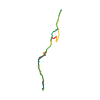
Ski tour · Kanton Bern. The published line is 12.7 km long.
Map layers
Take the route with you
Download GPX ↓Original route geometry with estimated elevations from our terrain model. No account or app required.
ODbL 1.0 + CC BY-SA 3.0 FR · Licence. Source credits are included in the file.
- Highest point
- ≈ 2,422 m
Source directions
##Montée
De Chireltal Säge (scierie au terminus du déneigement, 1108 m, quelques places de parc, 3-4 km d'Horboden), suivre d'abord la route sur env. 1.5 km, la quitter à droite au niveau du pont de Faissebode (1238 m) pour rejoindre les chalets de Gurschwald (1340 m) en coupant les lacets.
Poursuivre un peu à plat vers le S jusqu'aux chalets de Ramsen (1443 m), s'élever dans une trouée forestière plus raide jusqu'à un replat, laisser à droite le chalet d'Abendmatte (1760 m, trace vers le Gurbsgrat) pour gagner les alpages de Bütschi (1938 m) par une courte pente raide.
Monter ensuite droit dans la face parsemée d'ilots rocheux jusqu'à une encoche (la fin à pied) d'où le sommet se rejoint en quelques minutes par une arête neigeuse facile.
##Descente
Par le même itinéraire, sur le haut on peut aussi utiliser l'épaule NE avant de revenir vers le centre de la face.
Source safety information
* On peut aussi accéder aux alpages de Bütschi (1938 m) en suivant l'itinéraire du [[routes/320118|versant W du Wiriehore]] et en franchissant le col 2031 m au SW du Wiriehore. Les 250 derniers mètres oscillent entre 38° et 40°, conditions très sûres requises.
The map shows the published line. Provider ascent and descent retain their original meaning; estimates along the line are marked ≈. An additional return route is not automatically included in the line. Elevation profile estimated from Copernicus DEM. Provider statistics may differ.
Weather · next 48 hours
Loading weather …
BULLETIN
Avalanche bulletins along this route
Bulletin regions along this line: Obersimmental
Regional avalanche bulletins do not assess an individual route. Check validity, elevation and aspect.
NATUR · NATURE
Protected areas along the route
Grosswaldreservat Diemtigtal
Waldreservate
Kartendarstellung vereinfacht; maßgeblich ist die verlinkte Originalquelle.
Ramse
Bundesinventar der Trockenwiesen und -weiden von nationaler Bedeutung
Kartendarstellung vereinfacht; maßgeblich ist die verlinkte Originalquelle.
Open on your iPhone · QR
Source & data
Camptocamp · Camptocamp-Association, Céline Stern-Kiener, BertrandSemelet, José Picheral, Guillaume Blanc, rabot · https://www.camptocamp.org/routes/50328 · Coordinates reprojected; DEM elevation estimates · ODbL 1.0 + CC BY-SA 3.0 FR
Camptocamp · 2019-02-06T09:14:16.361940+00:00
Produced using Copernicus WorldDEM-30 © DLR e.V. 2010-2014 and © Airbus Defence and Space GmbH 2014-2018 provided under COPERNICUS by the European Union and ESA; all rights reserved.
Tour-ID: c2c:route/50328 · Revision: bb5554b3ee69