
GeoSphere Austria · sources
Elevation profile
Snow depth
Model · 1 kmLoading snow model …
- Distance
- 8.2 km
- Ascent
- ≈ 1,451 m
- Descent from source
- 1,440 m
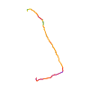
Ski tour · Kanton Wallis. The published line is 8.2 km long.
Map layers
Take the route with you
Download GPX ↓Original route geometry with estimated elevations from our terrain model. No account or app required.
swisstopo OGD · Licence. Source credits are included in the file.
- Highest point
- ≈ 2,741 m
The map shows the published line. Provider ascent and descent retain their original meaning; estimates along the line are marked ≈. An additional return route is not automatically included in the line. Elevation profile estimated from Copernicus DEM. Provider statistics may differ.
Weather · next 48 hours
Loading weather …
BULLETIN
Avalanche bulletins along this route
Bulletin regions along this line: Southern Obergoms
Regional avalanche bulletins do not assess an individual route. Check validity, elevation and aspect.
NATUR · NATURE
Protected areas along the route
No protected area was found along this line in the available dataset. Follow local notices.
Open on your iPhone · QR
Source & data
©swisstopo · swisstopo OGD
swisstopo · 2025-12-11
Produced using Copernicus WorldDEM-30 © DLR e.V. 2010-2014 and © Airbus Defence and Space GmbH 2014-2018 provided under COPERNICUS by the European Union and ESA; all rights reserved.
Tour-ID: swisstopo:a0039ca7-e8f6-4fec-a282-4bc25d1b1aba · Revision: d35033f145db