
GeoSphere Austria · sources
Ski tours · Aosta
Cima della Valetta di Bardoney · Cima Valletta di Bardoney : da Lillaz
Elevation profile
Snow depth
Model · 1 kmLoading snow model …
- Distance
- 18.2 km
- Ascent
- 1,150 m
- Descent from source
- 1,150 m
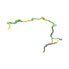
Ski tour · Aosta. The published line is 18.2 km long.
Map layers
Take the route with you
Download GPX ↓Original route geometry with estimated elevations from our terrain model. No account or app required.
ODbL 1.0 + CC BY-SA 3.0 FR · Licence. Source credits are included in the file.
- Highest point
- ≈ 2,647 m
Source directions
[img=891564 right]itinéraire depuis le Vallon d'Urtier[/img]
Da Lillaz salire nel Vallone dell' Urtier (in MTB per la poderale, a piedi per il sentiero dell' Alta Via n° 2) fino al ponte poco dopo il Bouc (1850m), se si segue la poderale bisogna scendere dai 1900m circa con 3-4 tornanti al ponte. Dal ponte seguire la strada che porta a Pianasse (1921m) sempre sul tracciato dell' Alta Via n° 2. Qui risalire in direzione sud il canalone boscoso e ripido alla destra della Testa Goilles (2367m), al suo termine piegare gradatamente a destra nel bosco rado fino ad uscire su pendii piu' ampi da dove si vede la ripida pala triangolare della cima. Puntare, in direzione ovest, ad una fascia rocciosa che si raggiunge per un pendio ripido esposto ad est, dalle rocce per il ripido pendio nordest direttamente in cima (35°). Discesa per l' itinerario di salita con possibili varianti nel bosco.
Source safety information
Consigliato in primavera l' avvicinamento in MTB per la poderale, in inverno meglio il sentiero dell' AV n° 2. Con la MTB considerare 150-200m di dislivello in piu dovuti ai saliscendi della poderale. Gita su pendenze sempre sostenute dal ponte del Bouc in su.
Source directions
[img=891564 right]itinéraire depuis le Vallon d'Urtier[/img]
En attendant la version française, voir la description dans sa version italienne
The map shows the published line. Provider ascent and descent retain their original meaning; estimates along the line are marked ≈. An additional return route is not automatically included in the line. Elevation profile estimated from Copernicus DEM. Provider statistics may differ.
Weather · next 48 hours
Loading weather …
BULLETIN
Avalanche bulletins along this route
No EUREGIO bulletin region is assigned to this line.
Check the official report for current danger and validity. Avalanche warning services
Regional avalanche bulletins do not assess an individual route. Check validity, elevation and aspect.
NATUR · NATURE
Protected areas along the route
P N DEL GRAN PARADISO
Parco Nazionale
Kartendarstellung vereinfacht; maßgeblich ist die verlinkte Originalquelle.
Open on your iPhone · QR
Source & data
Camptocamp · Christian, Paolo Recalcati · https://www.camptocamp.org/routes/874983 · Coordinates reprojected; DEM elevation estimates · ODbL 1.0 + CC BY-SA 3.0 FR
Camptocamp · 2019-05-18T09:10:48.115891+00:00
Produced using Copernicus WorldDEM-30 © DLR e.V. 2010-2014 and © Airbus Defence and Space GmbH 2014-2018 provided under COPERNICUS by the European Union and ESA; all rights reserved.
Tour-ID: c2c:route/874983 · Revision: fb501693a663