
GeoSphere Austria · sources
Elevation profile
Snow depth
Model · 1 kmLoading snow model …
- Distance
- 8.2 km
- Ascent
- 1,350 m
- Descent from source
- 1,350 m
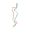
Ski tour · Kanton Wallis. The published line is 8.2 km long.
Map layers
Take the route with you
Download GPX ↓Original route geometry with estimated elevations from our terrain model. No account or app required.
ODbL 1.0 + CC BY-SA 3.0 FR · Licence. Source credits are included in the file.
- Highest point
- ≈ 2,512 m
Source directions
## Montée
De Dranse monter au SW à l'alpage du Creux 1627 m. Prendre le chemin du Tomelet (cote 1718 m). S'enfiler dans une petite combe en forêt se dirigeant plein S, pour atteindre le pt 2083 m à la sortie de la forêt continuer en suivant la croupe au ressaut avant
Traverser en direction SE, légère descente au départ et à niveau ensuite, afin de traverser la combe N de la Crêta de Vella. Sortir sur les pentes E qui conduisent au sommet.
## Descente
Par le même itinéraire.
### Variante
Possibilité de descendre par la combe N située sous le sommet et ensuite directement par le torrent. Quitter ce couloir un peu "jungle" à partir de 1900 m avant son rétrécissement à 1760 m et prendre une route forestière bien plate ramenant vers l'itinéraire de montée au Tomelet. La trace GPS associée tient compte de cette variante.
Source safety information
- Pas de faux plats.
- Course idéale par mauvaises conditions, en s'arrêtant vers 2000 m, à la sortie de la forêt dense.
The map shows the published line. Provider ascent and descent retain their original meaning; estimates along the line are marked ≈. An additional return route is not automatically included in the line. Elevation profile estimated from Copernicus DEM. Provider statistics may differ.
Weather · next 48 hours
Loading weather …
BULLETIN
Avalanche bulletins along this route
Bulletin regions along this line: Val d'Entremont - Val Ferret
Regional avalanche bulletins do not assess an individual route. Check validity, elevation and aspect.
NATUR · NATURE
Protected areas along the route
Val Ferret / Combe de l'A
Bundesinventar der eidgenössischen Jagdbanngebiete
Kartendarstellung vereinfacht; maßgeblich ist die verlinkte Originalquelle.
Open on your iPhone · QR
Source & data
Camptocamp · Camptocamp-Association, Céline Stern-Kiener, Christian, Jean-Louis Pitteloud, Borut, rabot · https://www.camptocamp.org/routes/45157 · Coordinates reprojected; DEM elevation estimates · ODbL 1.0 + CC BY-SA 3.0 FR
Camptocamp · 2018-08-04T10:06:19.080572+00:00
Produced using Copernicus WorldDEM-30 © DLR e.V. 2010-2014 and © Airbus Defence and Space GmbH 2014-2018 provided under COPERNICUS by the European Union and ESA; all rights reserved.
Tour-ID: c2c:route/45157 · Revision: 2189a2f93251