
GeoSphere Austria · sources
Elevation profile
Snow depth
Model · 1 kmLoading snow model …
- Distance
- 7.1 km
- Ascent
- 784 m
- Descent from source
- 784 m
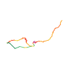
Ski tour · Kanton Wallis. The published line is 7.1 km long.
Map layers
Take the route with you
Download GPX ↓Original route geometry with estimated elevations from our terrain model. No account or app required.
ODbL 1.0 + CC BY-SA 3.0 FR · Licence. Source credits are included in the file.
- Highest point
- ≈ 1,824 m
Source summary
Superbe pente de 300 m. Elle est visible peu avant d'arriver au sommet et donne très envie...
Source directions
Montée
Depuis Grand Paradis (Champéry), monter à Barme par les Champs de Barme. Arrivé au replat, prendre à droite de la rivière en longeant la forêt jusqu'à un chemin pour le Col de Cou. L'emprunter et, vers le point 1619, continuer à gauche par la crête jusqu'à la Croix d'Increnne.
Descente
Descendre une quarantaine de mètres par la voie de montée et basculer dans le versant SE jusqu'au point 1520 m. De là, rejoindre Barme et descendre par les Champs de Barme, puis par la piste.
Source safety information
Étant donné la longueur de la course, on peut facilement enchaîner avec une multitude d'itinéraires. qui se trouvent dans les alentours.
The map shows the published line. Provider ascent and descent retain their original meaning; estimates along the line are marked ≈. An additional return route is not automatically included in the line. Elevation profile estimated from Copernicus DEM. Provider statistics may differ.
Weather · next 48 hours
Loading weather …
BULLETIN
Avalanche bulletins along this route
Bulletin regions along this line: Monthey - Val d'Illiez
Regional avalanche bulletins do not assess an individual route. Check validity, elevation and aspect.
NATUR · NATURE
Protected areas along the route
Barme
Bundesinventar der Hoch- und Übergangsmoore von nationaler Bedeutung
Kartendarstellung vereinfacht; maßgeblich ist die verlinkte Originalquelle.
Open on your iPhone · QR
Source & data
Camptocamp · Jérémy Cherix, rabot, botopo · https://www.camptocamp.org/routes/848069 · Coordinates reprojected; DEM elevation estimates · ODbL 1.0 + CC BY-SA 3.0 FR
Camptocamp · 2019-06-08T03:30:06.117827+00:00
Produced using Copernicus WorldDEM-30 © DLR e.V. 2010-2014 and © Airbus Defence and Space GmbH 2014-2018 provided under COPERNICUS by the European Union and ESA; all rights reserved.
Tour-ID: c2c:route/848069 · Revision: 48b5aa5b01e7