
GeoSphere Austria · sources
Ski tours · Département Haute-Savoie
Croix de l'Écuelle ou Pointe de la Croix · Face N
Elevation profile
Snow depth
Model · 1 kmLoading snow model …
- Distance
- 5.1 km
- Ascent
- 700 m
- Descent from source
- 700 m
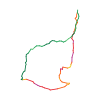
Ski tour · Département Haute-Savoie. The published line is 5.1 km long.
Map layers
Take the route with you
Download GPX ↓Original route geometry with estimated elevations from our terrain model. No account or app required.
ODbL 1.0 + CC BY-SA 3.0 FR · Licence. Source credits are included in the file.
- Highest point
- ≈ 1,806 m
Source directions
##Montée
De la Lanche (1110 m) suivre l'itinéraire normal de l'Ecuelle par le sentier dans la forêt. Attention de ne pas se laisser tenter par une large piste forestière : en général ça passe très mal au-dessus, il vaut mieux bien prendre à gauche tout de suite avant d'entrer dans les bois, bref suivre l'indication du panneau d'été.
Rejoindre le départ du télésiège de l'Ecuelle et par un petit bout de piste arriver au col de l'Ecuelle puis l'arête E de la Croix de l'Ecuelle (dénommée pointe de la Croix sur IGN) jusqu'au sommet (croix). Possibilité aussi de remonter la combe ENE et rejoindre l'arête un peu plus haut.
##Descente
Prendre droit sous la croix dans la face large, avec éventuellement quelques vernes au départ suivant l'enneigement. En bas des grandes pentes, tirer un peu à droite dans des pentes larges mais un peu encombrées de vernes ou directement dans un couloir/ravin plus raide et étroit, pouvant présenter une petite barre. Rejoindre le Paquis des Mouilles puis les Druges, les Vergay et enfin la Lanche.
Source safety information
- Face assez large et peu exposée.
- Orientation plein N
The map shows the published line. Provider ascent and descent retain their original meaning; estimates along the line are marked ≈. An additional return route is not automatically included in the line. Elevation profile estimated from Copernicus DEM. Provider statistics may differ.
Weather · next 48 hours
Loading weather …
BULLETIN
Avalanche bulletins along this route
No EUREGIO bulletin region is assigned to this line.
Check the official report for current danger and validity. Avalanche warning services
Regional avalanche bulletins do not assess an individual route. Check validity, elevation and aspect.
NATUR · NATURE
Protected areas along the route
No protected area was found along this line in the available dataset. Follow local notices.
Open on your iPhone · QR
Source & data
Camptocamp · Camptocamp-Association, Christian, alexduchablais, zbebb, richardweng, rabot, botopo · https://www.camptocamp.org/routes/49062 · Coordinates reprojected; DEM elevation estimates · ODbL 1.0 + CC BY-SA 3.0 FR
Camptocamp · 2019-08-22T03:52:37.080673+00:00
Produced using Copernicus WorldDEM-30 © DLR e.V. 2010-2014 and © Airbus Defence and Space GmbH 2014-2018 provided under COPERNICUS by the European Union and ESA; all rights reserved.
Tour-ID: c2c:route/49062 · Revision: 4802a34b5256