
GeoSphere Austria · sources
Elevation profile
Snow depth
Model · 1 kmLoading snow model …
- Distance
- 5.8 km
- Ascent
- 1,270 m
- Descent from source
- 1,270 m
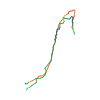
Ski tour · Kanton Wallis. The published line is 5.8 km long.
Map layers
Take the route with you
Download GPX ↓Original route geometry with estimated elevations from our terrain model. No account or app required.
ODbL 1.0 + CC BY-SA 3.0 FR · Licence. Source credits are included in the file.
- Highest point
- ≈ 2,139 m
Source directions
##Montée
De la Revenette (880), suivre la route de Bise-Ubine jusqu'au carrefour des Quatre-Chemins où l'on poursuit vers le lac de Fontaine (1350) et finalement les chalets de Bise (1502).
Se diriger alors au NW vers la Dent du Velan pour atteindre le col d'Ugeon (2018). Du col, prendre plein S et atteindre rapidement le sommet de la Dent du Loup (2151 - pointement sur l'arête N issue des Cornettes de Bise).
##Descente
Même itinéraire
Source safety information
- La dénivellation totale peut grandement varier selon que la route est barrée (chaîne) à la Revenette ou pas. La chaîne est en général en place de décembre à avril. Pendant les autres périodes, selon l'enneigement de la route on peut atteindre Fontaine voire Bise.
- Orientation W dans le vallon de Bise, bien abrité du soleil par les contreforts des cornettes. Réalisable relativement tôt et tard en saison.
The map shows the published line. Provider ascent and descent retain their original meaning; estimates along the line are marked ≈. An additional return route is not automatically included in the line. Elevation profile estimated from Copernicus DEM. Provider statistics may differ.
Weather · next 48 hours
Loading weather …
BULLETIN
Avalanche bulletins along this route
Bulletin regions along this line: Vouvry
Regional avalanche bulletins do not assess an individual route. Check validity, elevation and aspect.
NATUR · NATURE
Protected areas along the route
Montagne de Bise Cornettes Chauffé Arvouin
Arrêté de protection de biotope
Kartendarstellung vereinfacht; maßgeblich ist die verlinkte Originalquelle.
La Dent D'Oche, Les Cornettes De Bise Et Leurs Abords
Site classé selon la loi de 1930
Kartendarstellung vereinfacht; maßgeblich ist die verlinkte Originalquelle.
Open on your iPhone · QR
Source & data
Camptocamp · Camptocamp-Association, alexduchablais, botopo · https://www.camptocamp.org/routes/49382 · Coordinates reprojected; DEM elevation estimates · ODbL 1.0 + CC BY-SA 3.0 FR
Camptocamp · 2018-09-29T09:35:18.799682+00:00
Produced using Copernicus WorldDEM-30 © DLR e.V. 2010-2014 and © Airbus Defence and Space GmbH 2014-2018 provided under COPERNICUS by the European Union and ESA; all rights reserved.
Tour-ID: c2c:route/49382 · Revision: a9316c8128f4