
GeoSphere Austria · sources
Ski tours · Kanton Wallis
Gälmji-Simplon · dal Passo del Sempione con discesa per la Nessultal
Elevation profile
Snow depth
Model · 1 kmLoading snow model …
- Distance
- 11.8 km
- Ascent
- 650 m
- Descent from source
- 1,260 m
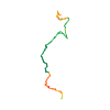
Ski tour · Kanton Wallis. The published line is 11.8 km long.
Map layers
Take the route with you
Download GPX ↓Original route geometry with estimated elevations from our terrain model. No account or app required.
ODbL 1.0 + CC BY-SA 3.0 FR · Licence. Source credits are included in the file.
- Highest point
- ≈ 2,370 m
Source summary
Gita ridotta in termini di dislivello e difficoltà rispetto alla discesa dallo Spitzhorli per il versante NE, ma che ne ricalca le caratteristiche e l'ambiente della Nessultal. L'esposizione permette di trovare spesso ottima neve polverosa.
Source directions
Dal Hotel Monte Leone seguire brevemente l'itinerario per lo Spitzhorli e a quota 2180 ca. girare in direzione N percorrendo l'anpio vallone che porta al colle Gälmji (2372) che si apre tra il Tochuhorn e lo Staldhorn.
Scendere in direzione N per ampi pendii sostenuti che richiedono neve sicura. Ai primi radi larici tenersi dapprima su un dosso e quindi seguire orientativamente il sentiero estivo che tra radure e bosco più fitto raggiunge l'alpeggio di Ober Nessultal. Proseguire nella pineta in direzione NE fino a Unner Nessultal. Da qui una strada di servizio permette di raggiungere la valle del torrente Taferna che si attraversa su un ponte a quota 1248. Continuando in direzione N si raggiunge il ponte sul Ganterbach a quota 1117. Da qui si risale lungo la strada fino a Schallberg sulla strada del Sempione (fermata del postale)
The map shows the published line. Provider ascent and descent retain their original meaning; estimates along the line are marked ≈. An additional return route is not automatically included in the line. Elevation profile estimated from Copernicus DEM. Provider statistics may differ.
Weather · next 48 hours
Loading weather …
BULLETIN
Avalanche bulletins along this route
Bulletin regions along this line: Northern Simplon region, Southern Simplon region
Regional avalanche bulletins do not assess an individual route. Check validity, elevation and aspect.
NATUR · NATURE
Protected areas along the route
Grund
Bundesinventar der Auengebiete von nationaler Bedeutung
Kartendarstellung vereinfacht; maßgeblich ist die verlinkte Originalquelle.
Undre Schallberg
Bundesinventar der Trockenwiesen und -weiden von nationaler Bedeutung
Kartendarstellung vereinfacht; maßgeblich ist die verlinkte Originalquelle.
Open on your iPhone · QR
Source & data
Camptocamp · Giancarlo Langini · https://www.camptocamp.org/routes/1171747 · Coordinates reprojected; DEM elevation estimates · ODbL 1.0 + CC BY-SA 3.0 FR
Camptocamp · 2020-02-09T17:57:42.461355+00:00
Produced using Copernicus WorldDEM-30 © DLR e.V. 2010-2014 and © Airbus Defence and Space GmbH 2014-2018 provided under COPERNICUS by the European Union and ESA; all rights reserved.
Tour-ID: c2c:route/1171747 · Revision: f7a226c8f565