
GeoSphere Austria · sources
Elevation profile
Snow depth
Model · 1 kmLoading snow model …
- Distance
- 3.8 km
- Ascent
- 1,070 m
- Descent from source
- 1,070 m
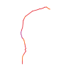
Ski tour · Kanton Tessin. The published line is 3.8 km long.
Map layers
Take the route with you
Download GPX ↓Original route geometry with estimated elevations from our terrain model. No account or app required.
ODbL 1.0 + CC BY-SA 3.0 FR · Licence. Source credits are included in the file.
- Highest point
- ≈ 2,110 m
Source directions
## Salita
Dalla chiesa di **Scatiàn** (1054m) sopra Colla, salire per la stradina o per il sentiero a **Barchi di Colla** (1243m); seguire verso N l'evidente dorsale che dopo la **quota 1361m** ha un breve tratto leggermente più ripido, quindi per terreno ampio e poco pendente raggiungere lo spartiacque con la Val Serdena verso **quota 1700m**. Da qui, piegando a destra (E), risalire senza difficoltà la dorsale occidentale del Garzirola sino alla **vetta**
*Con condizioni di neve assestata e non ghiacciata è possibile da quota 1400m ca abbandonare la dorsale e dopo un traverso verso E raggiungere la dorsale occidentale del Garzirola risalendo gli ampi pendii della destra idrografica della Valle del Ciapelon*
## Discesa
Per lo stesso itinerario, oppure a Bogno o Certara via Passo San Lucio, oppure a Corticiasca via Cima Moncucco (1725) e M. Bar (1816).
Source safety information
La dorsale occidentale del Garzirola è sovente battuta dai venti, frequente trovare neve ghiacciata o ampie zone erose
The map shows the published line. Provider ascent and descent retain their original meaning; estimates along the line are marked ≈. An additional return route is not automatically included in the line. Elevation profile estimated from Copernicus DEM. Provider statistics may differ.
Weather · next 48 hours
Loading weather …
BULLETIN
Avalanche bulletins along this route
Bulletin regions along this line: Lugano area
Regional avalanche bulletins do not assess an individual route. Check validity, elevation and aspect.
NATUR · NATURE
Protected areas along the route
No protected area was found along this line in the available dataset. Follow local notices.
Open on your iPhone · QR
Source & data
Camptocamp · Camptocamp-Association, Céline Stern-Kiener, cimaxi, itineralp, rabot · https://www.camptocamp.org/routes/46295 · Coordinates reprojected; DEM elevation estimates · ODbL 1.0 + CC BY-SA 3.0 FR
Camptocamp · 2017-10-30T23:33:27.804758+00:00
Produced using Copernicus WorldDEM-30 © DLR e.V. 2010-2014 and © Airbus Defence and Space GmbH 2014-2018 provided under COPERNICUS by the European Union and ESA; all rights reserved.
Tour-ID: c2c:route/46295 · Revision: a5a62df8988c