
GeoSphere Austria · sources
Elevation profile
Snow depth
Model · 1 kmLoading snow model …
- Distance
- 9.8 km
- Ascent
- 1,340 m
- Descent along this line
- ≈ 1,442 m
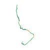
Ski tour · Kanton Bern. The published line is 9.8 km long.
Map layers
Take the route with you
Download GPX ↓Original route geometry with estimated elevations from our terrain model. No account or app required.
ODbL 1.0 + CC BY-SA 3.0 FR · Licence. Source credits are included in the file.
- Highest point
- ≈ 2,200 m
Source directions
##Montée # 4h30
Du parking de Urbach, prendre la route d'alpage qui mène à Rohr Matten (1043 m). Traverser le replat qui suit puis 2 solutions selon l'enneigement:
* si l'enneigement le permet, descendre dans le vallon et remonter la gorge sur les débris d'avalanche (attention)
* sinon suivre le chemin de Gaulihütte (délicat à ski si neige gelée, exposé aux avalanches).
Les 2 variantes se rejoignent à Schräterren (1460 m). Remonter à droite de belles pentes puis poursuivre par un goulet jusqu'à 1800 m. Franchir un petit mur à droite et remonter des grandes pentes droit dessus (Hohwang) jusqu'à 3 cairns (2222 m).
Par une traversée délicate en face SE sous le Täalligrat, rejoindre la Gaulihütte.
Source safety information
* Attention, la montée à la cabane ne doit s'entreprendre que par conditions sûres!
The map shows the published line. Provider ascent and descent retain their original meaning; estimates along the line are marked ≈. An additional return route is not automatically included in the line. Elevation profile estimated from Copernicus DEM. Provider statistics may differ.
Weather · next 48 hours
Loading weather …
BULLETIN
Avalanche bulletins along this route
Bulletin regions along this line: Guttannen
Regional avalanche bulletins do not assess an individual route. Check validity, elevation and aspect.
NATUR · NATURE
Protected areas along the route
Gauligletscher
Bundesinventar der Auengebiete von nationaler Bedeutung
Kartendarstellung vereinfacht; maßgeblich ist die verlinkte Originalquelle.
Open on your iPhone · QR
Source & data
Camptocamp · Céline Stern-Kiener, sissssou, rabot, botopo · https://www.camptocamp.org/routes/458225 · Coordinates reprojected; DEM elevation estimates · ODbL 1.0 + CC BY-SA 3.0 FR
Camptocamp · 2023-08-14T17:04:08.010832+00:00
Produced using Copernicus WorldDEM-30 © DLR e.V. 2010-2014 and © Airbus Defence and Space GmbH 2014-2018 provided under COPERNICUS by the European Union and ESA; all rights reserved.
Tour-ID: c2c:route/458225 · Revision: 293b663d0b03