
GeoSphere Austria · sources
Elevation profile
Snow depth
Model · 1 kmLoading snow model …
- Distance
- 5.4 km
- Ascent
- 1,677 m
- Descent from source
- 1,677 m
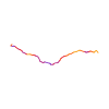
Ski tour · Kanton Bern. The published line is 5.4 km long.
Map layers
Take the route with you
Download GPX ↓Original route geometry with estimated elevations from our terrain model. No account or app required.
ODbL 1.0 + CC BY-SA 3.0 FR · Licence. Source credits are included in the file.
- Highest point
- ≈ 3,058 m
Source summary
Lohnende und alpine Tagestour im Grimselgebiet, welche üblicherweise bis relativ spät in den Frühsommer gemacht werden kann
Source directions
## Aufstieg
[img=259513 right]Der Gipfelaufbau und -Couloir des Golegghorns[/img][img=259701 right]Die untere Rinne zwischen 2060 und 2160m[/img]
Vom Hotel Handel folgt man erst kurz Richtung NW der Teerstrasse bis zu einem Parkplatz. Nun steigt man mehr oder weniger dem Sommerweg entlang über den föhrendurchsetzten Hang hoch und gelang zur Ebene *Erlen* (P.1688m). Man folgt dem Weg Richtung *Egg* (1976m) wobei man den Bach auf der Brücke überquert. Dort steigt man das Couloir, welches man am oberen Rand nach links verlässt, in gestuftem Gelände gegen den markanten Felskopf von P.2523 hochzusteigen. Den P.2623 umgeht man rechts (W) und steigt weiter gegen gegen den Grat der Felsbastion von P.2861 hoch und quert dann W-wärts auf den Golegg-Gletscher. Über diesen geht man direkt auf den Gipfel zu und steigt dann in das steile und schattige Coulouir, welches aus dem S-Grat des Golegghorns herunterzieht. Bei heiklen Verhältnissen kann es einfacher sein, das Couloir zu Fuß zu ersteigen. Von der Lücke folgt man dem einfachen und breiten S-Grat in wenigen Metern zum Gipfel.
## Abfahrt
auf der Aufstiegsroute
Source safety information
- Die Hauptschwierigkeiten sind das Gipfelcoulouir (bis 41°?, gut 100hm), sowie das Colour zwischen 2060m und 2160m (bis 35°?). Harscheisen sind oft notwendig. Sichere Lawinenverhältnisse sind vorausgesetzt.
- Relativ lange aber keinesfalls langeweilige Route, da landschaftlich sehr abwechslungsreich.
- Insbesondere im Frühling ist ein früher Start angezeigt, da die Route voll E orientiert ist.
- Die Route kann auch von der Gruebenhütte aus gemacht werden.
Source directions
##Montée
Depuis l'hôtel Handegg remonter le long de la voir de funiculaire jusque 1620 m. environ, de là rejoindre la combe Arlen. Remonter la vaste combe qui vient du Chlyne Diamantstock jusqu'à l'altitude 1950 m.
Prendre vers l'W un couloir raide qui continue ensuite en une succession de gradins jusque sous une falaise (2515 m) qui se contourne par la droite.
Ensuite rejoindre vers l'W une brèche qui permet de rejoindre le Golegg Gletscher (coulées d'avalanches). Remonter ce glacier plutôt rive droite afin de gagner le pied d'un couloir raide. Le remonter jusqu'au col (attention corniche sommitale qui menace le couloir !).
De là, le sommet s'atteint facilement en quelques minutes.
##Descente
Par le même itinéraire.
Source safety information
* Malgré l'altitude modeste, belle impression de haute montagne au sommet.
* Dénivelé assez important mais itinéraire très varié donc ça passe bien.
* Orientation plein E, il faut donc partir très tôt (descendre avant 10 ou 11h.)
The map shows the published line. Provider ascent and descent retain their original meaning; estimates along the line are marked ≈. An additional return route is not automatically included in the line. Elevation profile estimated from Copernicus DEM. Provider statistics may differ.
Weather · next 48 hours
Loading weather …
BULLETIN
Avalanche bulletins along this route
Bulletin regions along this line: Guttannen, Grimsel Pass
Regional avalanche bulletins do not assess an individual route. Check validity, elevation and aspect.
NATUR · NATURE
Protected areas along the route
No protected area was found along this line in the available dataset. Follow local notices.
Open on your iPhone · QR
Source & data
Camptocamp · Camptocamp-Association, Céline Stern-Kiener, HakenHans, rabot, botopo · https://www.camptocamp.org/routes/50803 · Coordinates reprojected; DEM elevation estimates · ODbL 1.0 + CC BY-SA 3.0 FR
Camptocamp · 2018-11-23T08:41:17.165202+00:00
Produced using Copernicus WorldDEM-30 © DLR e.V. 2010-2014 and © Airbus Defence and Space GmbH 2014-2018 provided under COPERNICUS by the European Union and ESA; all rights reserved.
Tour-ID: c2c:route/50803 · Revision: 2d6d495b8d2d