
GeoSphere Austria · sources
Elevation profile
Snow depth
Model · 1 kmLoading snow model …
- Distance
- 18.6 km
- Ascent
- 1,691 m
- Descent from source
- 1,691 m
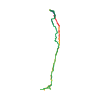
Ski tour · Sondrio. The published line is 18.6 km long.
Map layers
Take the route with you
Download GPX ↓Original route geometry with estimated elevations from our terrain model. No account or app required.
ODbL 1.0 + CC BY-SA 3.0 FR · Licence. Source credits are included in the file.
- Highest point
- ≈ 3,785 m
Source directions
[img=526558 right]Itinerario di salita da Pizzini. Due possibili varianti in basso.[/img]
## Salita
Dal parcheggio del RIFUGIO FORNI m 2170 seguire le indicazioni per il RIFUGIO PIZZINI. Dal rifugio salire verso il GRAN ZEBRÙ, aggirando a W oppure ad E (indifferentemente) l'isolotto roccioso che precede il canalino ripido che porta alla "Spalla" a circa 3450 m (immediatamente a W della quota 3462). Da qui si sale il ripido pendio soprastante, fino ad aggirare a destra (E) il salto finale, pervenendo sull'affilata cresta a breve distanza dalla croce di vetta. Molto spesso si sale solo con sci in spalla e ramponi ai piedi.
## Discesa
Lungo l'itinerario di salita (da non sottovalutare specialmente il traversino sotto la vetta, molto esposto, costretto e spesso ghiacciato).
Source safety information
* Tratti ripidi (più di 40°) impegnativi.
* La discesa sci ai piedi dalla vetta è S4/S5.
* La gita è effettuabile in giornata con buon allenamento.
* Il Rifugio Pizzini permette di affrontarla in due giorni.
Source summary
Un superbe itinéraire entre ski et alpinisme du sommet emblématique du massif
Source directions
[img=526558 right/]
##Montée
Du refuge Pizzini remonter les pentes S douces. Sans rejoindre le col du Pale Rosse contourner un éperon rocheux par la gauche ou par la droite pour atteindre un collu vers 3250 m. La pente se redresse jusqu'au pied du couloir S bien visible du bas. Remonter le couloir (40° sur 100 m env) pour déboucher dans la face SE vers 3450 m. Le passage par le col du Königsjoch, plus à droite, qui est parfois décrit n'est plus usité. Remonter la face SE (40° de moyenne sur 200 m mais large) jusqu’à une épaule où la pente s'adoucit. Contourner les rochers sommitaux par la droite : couloir raide (45°) qui conduit à l’arête finale, courte mais effilée.
Un dépôt des skis est fréquent sur l'épaule vers 3700 m.
##Descente
Lorsqu'on monte les skis jusqu'au sommet, on peut descendre une facette S depuis le bout de l'arête effilée, plus large que la fin du couloir de montée. On rejoint la face SE sur l'épaule.
Même itinéraire ensuite.
Source safety information
- Le refuge Pizzini est bien situé pour faire la course en 2 jours (D+ 1150 m le second jour).
- Cotation 4.3 à confirmer lorsqu'on skie depuis l'arête effilée.
- Cotation 4.2 pour la longueur des difficultés lorsqu'on skie depuis 3700 m.
- L'exposition n'est pas pesante en dessous de 3700 m car la face est assez longue, mais l'ambiance est assez impressionnante !
Source equipment information
Crampons, piolet
The map shows the published line. Provider ascent and descent retain their original meaning; estimates along the line are marked ≈. An additional return route is not automatically included in the line. Elevation profile estimated from Copernicus DEM. Provider statistics may differ.
Weather · next 48 hours
Loading weather …
BULLETIN
Avalanche bulletins along this route
Bulletin regions along this line: Ortler Range
Check the official report for current danger and validity. Avalanche warning services
Regional avalanche bulletins do not assess an individual route. Check validity, elevation and aspect.
NATUR · NATURE
Protected areas along the route
No protected area was found along this line in the available dataset. Follow local notices.
Open on your iPhone · QR
Source & data
Camptocamp · Camptocamp-Association, BertrandSemelet, José Picheral, Franco Pecchio, Gianluca Moroni, Michael Blum, Fabio Pola, cimaxi, Jé Rome, J-Marc, andreamilano, Antoine Marnat, rabot, botopo, CaBot · https://www.camptocamp.org/routes/47076 · Coordinates reprojected; DEM elevation estimates · ODbL 1.0 + CC BY-SA 3.0 FR
Camptocamp · 2026-02-06T11:26:11.434928+00:00
Produced using Copernicus WorldDEM-30 © DLR e.V. 2010-2014 and © Airbus Defence and Space GmbH 2014-2018 provided under COPERNICUS by the European Union and ESA; all rights reserved.
Tour-ID: c2c:route/47076 · Revision: b93cd6f8ccee