
GeoSphere Austria · sources
Elevation profile
Snow depth
Model · 1 kmLoading snow model …
- Distance
- 12.6 km
- Ascent
- 1,270 m
- Descent from source
- 1,270 m
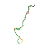
Ski tour · Tirol. The published line is 12.6 km long.
Map layers
Take the route with you
Download GPX ↓Original route geometry with estimated elevations from our terrain model. No account or app required.
ODbL 1.0 + CC BY-SA 3.0 FR · Licence. Source credits are included in the file.
- Highest point
- ≈ 2,535 m
Source summary
Itinéraire classique pour monter au Hirschpleifkopf, sommet évident marqué par une grande croix, qui domine Sankt Anton am Alberg, à l'écart de la station de ski. Il fournit une vue imprenable sur les sommets de cette partie du Tirol.
Source directions
## Itinéraire
De Bach, à l'extrémité NE de Sankt Anton am Alberg, prendre la piste qui remonte la rivière (le Bach, quoi), rive gauche jusqu'au fond. Poursuivre la piste qui grimpe ensuite les coteaux jusqu'au mirador à l'altitude de 1700 m. Du mirador, on continue la piste sur une centaine de mètres jusqu'à la prochaine courbe, où l'on la quitte. Monter une vingtaine de mètres au N dans la forêt pour prendre le chemin 642 (marques rouges et blanches) que l'on poursuit direction NE jusqu'à la Leutkircher Hütte (2270 m). De là, poursuivre la crête en direction W jusqu'à buter contre la face SW du Hirschpleifkopf que l'on remonte jusqu'au sommet (2549 m).
## Descente
Par le même itinéraire.
Source safety information
Une bonne partie de l'itinéraire se tient dans la forêt, plein S. S'assurer d'avoir l'enneigement nécessaire pour éviter de devoir porter. Cependant, la partie inférieure, dans la piste, garde la neige jusqu'à tard en saison. La municipalité de Sankt Anton entretient toutes ces pistes qui permettent de monter à ski jusqu'à l'étage supérieur de la montagne, au-delà des arbres.
The map shows the published line. Provider ascent and descent retain their original meaning; estimates along the line are marked ≈. An additional return route is not automatically included in the line. Elevation profile estimated from Copernicus DEM. Provider statistics may differ.
Weather · next 48 hours
Loading weather …
BULLETIN
Avalanche bulletins along this route
Bulletin regions along this line: AT-07-07
Check the official report for current danger and validity. Avalanche warning services
Regional avalanche bulletins do not assess an individual route. Check validity, elevation and aspect.
NATUR · NATURE
Protected areas along the route
Wildruhefläche Mehlbremmi
Wildruhefläche nach Jagdgesetz
access:conditional
only_trail_use @ (Nov 16-Apr 30)
description
Jagdfachlich erstellte, mit Bescheid festgelegte Wildruheflächen in denen besondere, im Tiroler Jagdgesetz festgelegte Einschränkungen bestehen!
description2
Wildruheflächen geben dem Wild während der Fütterungszeiten Raum für einen effektiven Rückzug von belastenden Störungen!
Kartendarstellung vereinfacht; maßgeblich ist die verlinkte Originalquelle.
Open on your iPhone · QR
Source & data
Camptocamp · Dani, Borut, janic · https://www.camptocamp.org/routes/1882919 · Coordinates reprojected; DEM elevation estimates · ODbL 1.0 + CC BY-SA 3.0 FR
Camptocamp · 2026-03-14T16:43:37.275998+00:00
Produced using Copernicus WorldDEM-30 © DLR e.V. 2010-2014 and © Airbus Defence and Space GmbH 2014-2018 provided under COPERNICUS by the European Union and ESA; all rights reserved.
Tour-ID: c2c:route/1882919 · Revision: 24d31ae71c86