
GeoSphere Austria · sources
Elevation profile
Snow depth
Model · 1 kmLoading snow model …
- Distance
- 7.1 km
- Ascent
- 1,100 m
- Descent from source
- 1,100 m
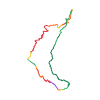
Ski tour · Kanton Freiburg. The published line is 7.1 km long.
Map layers
Take the route with you
Download GPX ↓Original route geometry with estimated elevations from our terrain model. No account or app required.
ODbL 1.0 + CC BY-SA 3.0 FR · Licence. Source credits are included in the file.
- Highest point
- ≈ 2,139 m
Source directions
!!!! Le Hochmatt se trouve en "zone de tranquillité" : cet itinéraire ne fait pas partie des accès ou descentes autorisé(e)s et ne doit donc pas être emprunté. Pour plus d'informations : http://www.zones-de-tranquillite.ch/wr400.php
##Accès
Traverser le village de La Villette. Avant le restaurant, tourner à droite et suivre la route qui mène au Bi Chalet (alt. 1176 m.).
La remonter le plus haut possible, si possible jusqu'au Bi Chalet.
##Montée
Suivre la route jusqu'au Bi Chalet (1176 m.). De là, se diriger vers la combe de Steiniger Tosse. Remonter toute la combe.
À 1900 m., prendre un couloir à gauche qui mène à la pente de neige sous la croix de la Hochmatt. Remonter cette dernière pente et on arrive à la croix.
**Variante:** Remonter par le Verdi et l'arête NW. Après la forêt continuer avec les crampons. Se méfier des corniches!
[img=1507632 right]Depuis la pointe du Verdi 12.02.2023[/img]
##Descente
Par le même itinéraire. Départ dans la combe sous la croix, pas celle de gauche. Bifurqué main gauche 50 m sous la croix pour atteindre le couloir.
Source safety information
* L'altitude de départ varie selon l'endroit où on doit parquer. La route d'accès n'est pas toujours dégagée.
* Le départ du couloir est très exposé : E4 sur 120 m depuis la croix.
* Attention au risque de plaques dans la pente de départ.
Source equipment information
* piolet
* crampons
The map shows the published line. Provider ascent and descent retain their original meaning; estimates along the line are marked ≈. An additional return route is not automatically included in the line. Elevation profile estimated from Copernicus DEM. Provider statistics may differ.
Weather · next 48 hours
Loading weather …
BULLETIN
Avalanche bulletins along this route
Bulletin regions along this line: Jaun
Regional avalanche bulletins do not assess an individual route. Check validity, elevation and aspect.
NATUR · NATURE
Protected areas along the route
Hochmatt-Motélon
Bundesinventar der eidgenössischen Jagdbanngebiete
Kartendarstellung vereinfacht; maßgeblich ist die verlinkte Originalquelle.
Open on your iPhone · QR
Source & data
Camptocamp · Camptocamp-Association, Céline Stern-Kiener, Christian, Patrick Vuilleumier, Thomas Charbonneau, Dahu_74, Choucroute, rabot, botopo, CaBot · https://www.camptocamp.org/routes/45492 · Coordinates reprojected; DEM elevation estimates · ODbL 1.0 + CC BY-SA 3.0 FR
Camptocamp · 2023-02-15T09:18:07.765435+00:00
Produced using Copernicus WorldDEM-30 © DLR e.V. 2010-2014 and © Airbus Defence and Space GmbH 2014-2018 provided under COPERNICUS by the European Union and ESA; all rights reserved.
Tour-ID: c2c:route/45492 · Revision: 179ccfd488d6