
GeoSphere Austria · sources
Elevation profile
Snow depth
Model · 1 kmLoading snow model …
- Distance
- 3.1 km
- Ascent
- 1,276 m
- Descent from source
- 1,276 m
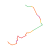
Ski tour · Kärnten. The published line is 3.1 km long.
Map layers
Take the route with you
Download GPX ↓Original route geometry with estimated elevations from our terrain model. No account or app required.
ODbL 1.0 + CC BY-SA 3.0 FR · Licence. Source credits are included in the file.
- Highest point
- ≈ 2,221 m
Source summary
Seppure basso l'Hochstuhl è la cima più alta delle Caravanche e l'itinerario si svolge per metà in Austria e per l'altra in Slovenia.
Source directions
##Accesso
Da Villach proseguire per l'autostrada verso Lubiana e prima del Karavanken tunnel, uscita Barental, Feistriz.
Da Feistriz (Austria) prendere la strada lungo la Barental che porta alla Stou hutte, e qua si parcheggia, e possibile in stagione avanzata proseguire per oltre due kilometri.
##Itinerario
Dalla Stou hutte proseguire per la strada forestale verso la Klagenfurt hutte, ed in corrispondenza del terzo tornante (dopo circa 45 minuti dal parcheggio) si devia completamente verso sinistra sotto le imponenti pareti della cima, fino all'evidente forcella Bielschitzasattel sulla destra. Da qui un leggero traverso nuovamente sulla destra fino ad entrare nell'ampio vallone che conduce alla cima slovena. Unico punto dolente e che dalla Bielschitzasattel bisogna perdere quota per oltre 100 metri, su un salto roccioso, che può dare qualche problema se troppo innevato. Il vallone dapprima lieve si trasforma aumentando notevolmente la pendenza, attenzione bisogna imboccare prima dell'anticima il canalone di sinistra.
Source safety information
Alloggio :
Visti gli altri itinerari di sci alpinismo è conveniente pernottare alla Klagenfurt hutte generalmente aperta.
Source equipment information
Ramponi, piccozza.
Source directions
## Accès
Juste au N du tunnel Karawanken sur l'autoroute Villach - Ljubljana, prendre la sortie St Jakob im Rosental, puis la direction Feistriz im Rosental.
Depuis Feistriz, prendre la route de la vallée Bärental jusqu'à Stouhütte où l'on se gare (en saison avancée, il est possible de continuer sur plus de deux kilomètres).
## Itinéraire
Bien que d'altitude modeste, le Hochstuhl/Stol est le plus haut sommet des Karavanke, et l'itinéraire est moitié en Autriche, moitié en Slovénie. Depuis Stouhütte, suivre la route forestière vers la Klagenfurterhütte. Au troisième virage (à environ 45min du parking), on passe complètement vers la gauche sous les imposantes parois, et à l'E de la Klagenturterspitze, on remonte jusqu'à l'évidente brèche Bielschitzasattel, vers la droite. Du col, traverser à droite pour passer dans le large vallon qui mène au sommet, côté slovène. Le seul hic est que depuis Bielschitzasattel, on doit perdre de l'altitude sur plus de 100 mètres le long d'un ressaut rocheux qui peut poser quelques problèmes en cas de gros enneigement (?). Débonnaire au début, le vallon devient de plus en plus raide. Avant l'antécime, prendre soin d'emprunter le couloir sur la gauche.
## Descente
Par le même itinéraire.
En ski, possibilités de descendre par les couloirs Gipfelrinne, Johannesrinne ou Grüne Ries (par difficulté décroissante).
Source safety information
Hébergement : compte tenu des autres itinéraires de ski, la Klagenfurterhütte reste généralement ouverte.
Source equipment information
- Piolet + crampons, en hiver.
Source safety information
Na zemljevidu črta označuje poletno pot, ikona pa zimsko bližnjico.
The map shows the published line. Provider ascent and descent retain their original meaning; estimates along the line are marked ≈. An additional return route is not automatically included in the line. Elevation profile estimated from Copernicus DEM. Provider statistics may differ.
Weather · next 48 hours
Loading weather …
BULLETIN
Avalanche bulletins along this route
No EUREGIO bulletin region is assigned to this line.
Check the official report for current danger and validity. Avalanche warning services
Regional avalanche bulletins do not assess an individual route. Check validity, elevation and aspect.
NATUR · NATURE
Protected areas along the route
Karavanke
posebno varstveno območje
Kartendarstellung vereinfacht; maßgeblich ist die verlinkte Originalquelle.
Naturschutzgebiete (NSG) - NSG Inneres Bodental u. Vertatscha
Naturschutzgebiet
Kartendarstellung vereinfacht; maßgeblich ist die verlinkte Originalquelle.
Karavanke
posebno varstveno območje
Kartendarstellung vereinfacht; maßgeblich ist die verlinkte Originalquelle.
Open on your iPhone · QR
Source & data
Camptocamp · Camptocamp-Association, Borut, Antoine Marnat, rabot, botopo · https://www.camptocamp.org/routes/47923 · Coordinates reprojected; DEM elevation estimates · ODbL 1.0 + CC BY-SA 3.0 FR
Camptocamp · 2024-09-04T10:47:42.883590+00:00
Produced using Copernicus WorldDEM-30 © DLR e.V. 2010-2014 and © Airbus Defence and Space GmbH 2014-2018 provided under COPERNICUS by the European Union and ESA; all rights reserved.
Tour-ID: c2c:route/47923 · Revision: faf7184453f2