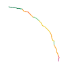
Original route geometry with estimated elevations from our terrain model. No account or app required.
CC BY 4.0 · Licence. Source credits are included in the file.
Highest point
≈ 827 m
Duration from source
38 min
Source difficultyL ÖW
Season from source
Mar, Apr, May, Jun, Jul, Aug, Sep, Oct, NovJanFebMarAprMayJunJulAugSepOctNovDec
↗ Refreshments indicated by source
Start from sourceParkplatz Rathlucken Hütte Bad Goisern, 4822 Bad Goisern am Hallstättersee
Finish from sourceEwige Wand Bad Goisern, 4822 Bad Goisern am Hallstättersee
Hints from sourceChildren · Couples · Culinary · Families · Friends · Parking · Pets · Seniors · Solo travellers · Themed trail · With children · Young people
These notices come from the stored source snapshot. They do not establish a current closure. Check the source website for current information.
Holzfiguren Erneuerung
Die Holzfiguren entlang des Sagenweges müssen in den nächsten Wochen erneuert werden.
Bitten um entsprechende Vorsicht entlang des Sagenweges, besonders unmittelbar bei den Figuren.
Klettern auf den Figuren ist strengstens verboten.
Begins according to source2026-04-23
The map shows the published line. Provider ascent and descent retain their original meaning; estimates along the line are marked ≈. An additional return route is not automatically included in the line. Elevation profile estimated from Copernicus DEM. Provider statistics may differ.
Weather · next 48 hours
Loading weather …
BULLETIN
Avalanche bulletins along this route
No EUREGIO bulletin region is assigned to this line.