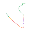
Original route geometry with estimated elevations from our terrain model. No account or app required.
CC BY-ND 4.0 · Licence. Source credits are included in the file.
Highest point
≈ 2,205 m
Source difficulty—
Season from source
—
Start from sourceIfenbahn-Bergstation
Finish from sourceHoher Ifen
Notices in the source snapshot
These notices come from the stored source snapshot. They do not establish a current closure. Check the source website for current information.
Quellenhinweise / Source notes / Note della fonte
Fußabschnitte laut Quelle / Foot sections in source / Tratti a piedi nella fonte.
Abschnitte mit besonderer Vorsicht laut Quelle / Extra caution sections in source / Tratti che richiedono particolare cautela nella fonte.
Die Quelle übernimmt keine Gewähr für Vollständigkeit oder Richtigkeit. / The source provides no guarantee of completeness or correctness. / La fonte non garantisce completezza o correttezza.