
GeoSphere Austria · sources
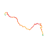
Elevation profile
Snow depth
Model · 1 kmLoading snow model …
- Distance
- 3.9 km
- Ascent
- 768 m
- Descent from source
- 768 m
Ski tour · Kanton Wallis. The published line is 3.9 km long.
Map layers
Take the route with you
Download GPX ↓Original route geometry with estimated elevations from our terrain model. No account or app required.
ODbL 1.0 + CC BY-SA 3.0 FR · Licence. Source credits are included in the file.
- Highest point
- ≈ 2,371 m
Source directions
Lasciata l'auto alla **partenza degli impianti di Rothwald (1745 m)** si segue la strada estiva che, attraverso il bosco, sale alle case di Rothwald. Al bivio si tiene la sinistra (a destra si arriva in cima allo skilift) e si raggiunge Wase (1960 m).
In alternativa, per aumentare un poco il dislivello, si può partire dalla **fermata di Egge del postale (1641 m)**, imboccando un sentiero che conduce brevemente ad una radura; salirla in direzione SE fino a delle baite. Superati alcuni paravalanghe, si raggiunge Wase.
Da **Wase** proseguire lungo il tracciato di una strada fino a Wintrigmatte e da qui puntare ad un evidente paravalanghe; quindi seguire il filo di cresta fino alla cima (evidente ometto). Dal paravalanghe in poi si compiono un paio di traversi da valutarsi al momento, in particolare l'ultimo tratto, una ventina di metri sotto la cima, è da valutarsi in loco.
Source safety information
Salita nel bosco molto bella e priva di pericoli; salendo da Rothwald prestare attenzione al bivio dopo 15/20 min dall'auto, occorre effettuare un lungo traverso e portarsi al paese di Wase e poi Wintrigmatte.
Da valutare dal paravalanghe in poi.
Traccia GPS -> solo salita
Source directions
##Montée
Depuis le point 1641 m sur la route du Simplon prendre le chemin menant à Obri et Wase ensuite direction Wintrigmatte 2042 m, rejoindre la crête de Hohture au point 2321 m.
Gagner le sommet par un cheminement facile.
##Descente
Par le même itinéraire en prenant bien le petit pont à 1937 m pour rejoindre Wase.
Source safety information
* Pas de difficultés, belle course d'initiation.
The map shows the published line. Provider ascent and descent retain their original meaning; estimates along the line are marked ≈. An additional return route is not automatically included in the line. Elevation profile estimated from Copernicus DEM. Provider statistics may differ.
Weather · next 48 hours
Loading weather …
BULLETIN
Avalanche bulletins along this route
Bulletin regions along this line: Northern Simplon region
Regional avalanche bulletins do not assess an individual route. Check validity, elevation and aspect.
NATUR · NATURE
Protected areas along the route
No protected area was found along this line in the available dataset. Follow local notices.
Open on your iPhone · QR
Source & data
Camptocamp · Céline Stern-Kiener, José Picheral, Stefano Mezzanzanica, Giancarlo Langini, rabot · https://www.camptocamp.org/routes/116957 · Coordinates reprojected; DEM elevation estimates · ODbL 1.0 + CC BY-SA 3.0 FR
Camptocamp · 2018-03-28T01:09:15.904269+00:00
Produced using Copernicus WorldDEM-30 © DLR e.V. 2010-2014 and © Airbus Defence and Space GmbH 2014-2018 provided under COPERNICUS by the European Union and ESA; all rights reserved.
Tour-ID: c2c:route/116957 · Revision: 84a849ca7a3f