
GeoSphere Austria · sources
Elevation profile
Snow depth
Model · 1 kmLoading snow model …
- Distance
- 8.6 km
- Ascent
- 300 m
- Descent from source
- 1,350 m
Ski tour · Kanton Bern. The published line is 8.6 km long.
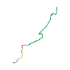
Map layers
Take the route with you
Download GPX ↓Original route geometry with estimated elevations from our terrain model. No account or app required.
ODbL 1.0 + CC BY-SA 3.0 FR · Licence. Source credits are included in the file.
- Highest point
- ≈ 2,372 m
Source directions
Dal rifugio del Wildhorn, scendere fino all'Iffigsee. Risalire verso N al col (2183m) e poi fino alla cima (libro di vetta in astuccio appeso al cartello segnaletico estivo).
La discesa finale si effettua lungo il docile versante NE in un ambiente bello e rilassante, a circa 2000m di quota si piega a NO e per terreno più ripido e coperto di rado bosco sino al vallone del Poris, lungo questo in moderata pendenza, direzione NE, si raggiunge il parcheggio di Poschenried.
Source directions
##Montée
Depuis la cabane Wildhorn, redescendre jusqu'à l'Iffigsee. Là, mettre les peaux et monter direction N au col (2183 m), puis plein E jusqu'au sommet.
On peut aussi remettre les peaux un peu avant vers 2000 m à la sortie du grand replat et couper vers le Col (terrain un peu raide avec des montées et descente)
##Descente
Du sommet, descendre plein E sur les crêtes (ne pas vouloir descendre au N trop tôt, il y a plein de méchantes barres qui coupent toutes les pentes raides bien tentantes) jusque vers Lindechäle.
Arrivé au premier sapin, descendre au N pour rejoindre la combe que l'on suit jusqu'à 1700 m. Là traverser à gauche pour rejoindre les champs situées au-dessus des voitures.
Source safety information
* Un petit passage de S3 vers Lindechäle.
Source equipment information
* Orientation peu évidente, sur la partie supérieure, en cas de brouillard, avec des falaises au N et au S.
The map shows the published line. Provider ascent and descent retain their original meaning; estimates along the line are marked ≈. An additional return route is not automatically included in the line. Elevation profile estimated from Copernicus DEM. Provider statistics may differ.
Weather · next 48 hours
Loading weather …
BULLETIN
Avalanche bulletins along this route
Bulletin regions along this line: Iffigen
Regional avalanche bulletins do not assess an individual route. Check validity, elevation and aspect.
NATUR · NATURE
Protected areas along the route
Pöris
Bundesinventar der Flachmoore von nationaler Bedeutung
Kartendarstellung vereinfacht; maßgeblich ist die verlinkte Originalquelle.
Lischböde
Bundesinventar der Flachmoore von nationaler Bedeutung
Kartendarstellung vereinfacht; maßgeblich ist die verlinkte Originalquelle.
Hubelmatte
Bundesinventar der Flachmoore von nationaler Bedeutung
Kartendarstellung vereinfacht; maßgeblich ist die verlinkte Originalquelle.
Pöriswaldmedli
Bundesinventar der Flachmoore von nationaler Bedeutung
Kartendarstellung vereinfacht; maßgeblich ist die verlinkte Originalquelle.
Open on your iPhone · QR
Source & data
Camptocamp · Camptocamp-Association, Céline Stern-Kiener, José Picheral, rabot, botopo · https://www.camptocamp.org/routes/48971 · Coordinates reprojected; DEM elevation estimates · ODbL 1.0 + CC BY-SA 3.0 FR
Camptocamp · 2018-06-05T12:40:25.300973+00:00
Produced using Copernicus WorldDEM-30 © DLR e.V. 2010-2014 and © Airbus Defence and Space GmbH 2014-2018 provided under COPERNICUS by the European Union and ESA; all rights reserved.
Tour-ID: c2c:route/48971 · Revision: 39ffa7c7ea0f