
GeoSphere Austria · sources
Elevation profile
Snow depth
Model · 1 kmLoading snow model …
- Distance
- 12.1 km
- Ascent
- 1,050 m
- Descent from source
- 1,050 m
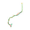
Ski tour · Tirol. The published line is 12.1 km long.
Map layers
Take the route with you
Download GPX ↓Original route geometry with estimated elevations from our terrain model. No account or app required.
ODbL 1.0 + CC BY-SA 3.0 FR · Licence. Source credits are included in the file.
- Highest point
- ≈ 3,162 m
Source summary
Classique des classiques à skis depuis le refuge. Une course sans grande difficulté si ce n'est les pentes inférieures. Le sommet s'atteint à pied, ce qui ajoute de l'intérêt et un peu de piquant à la course.
Source directions
##Montée
- Remonter le plat In der Sulza en restant bien rive gauche.
- Bifurquer alors au niveau du panneau indicateur de Lausbischl 2162 m dans des pentes assez raides ENE qui ont tendance à couler, le long du Wannenbach (on suit plus ou moins le sentier d'été, rapidement déneigé)
- Prendre le vallon entre le Wännenböden et le Wännenlehner et passer au pied du Roter Kogl pour monter plein S dans la combe issue du Rosskarferner (non crevassé)
- Monter en direction de l'arête pour déposer les skis et monter à pied au sommet - croix évidente !
##Descente
- par le même itinéraire
- par le même versant mais par le couloir situé au N du point 3039 m. cotation 4.1
- par les pentes SE (désescalade de 15 m depuis le sommet) qui rejoignent alors le Kuhscheibenferner
Source safety information
- attention aux premières pentes le long du Wannenbach, coulées possibles, exposition E
The map shows the published line. Provider ascent and descent retain their original meaning; estimates along the line are marked ≈. An additional return route is not automatically included in the line. Elevation profile estimated from Copernicus DEM. Provider statistics may differ.
Weather · next 48 hours
Loading weather …
BULLETIN
Avalanche bulletins along this route
Bulletin regions along this line: AT-07-14-03
Check the official report for current danger and validity. Avalanche warning services
Regional avalanche bulletins do not assess an individual route. Check validity, elevation and aspect.
NATUR · NATURE
Protected areas along the route
Ötztal
Naturpark
Kartendarstellung vereinfacht; maßgeblich ist die verlinkte Originalquelle.
Ruhegebiet Stubaier Alpen
Ruhegebiet
Kartendarstellung vereinfacht; maßgeblich ist die verlinkte Originalquelle.
Open on your iPhone · QR
Source & data
Camptocamp · Stephane Peiti, Sophie Ferlin · https://www.camptocamp.org/routes/426753 · Coordinates reprojected; DEM elevation estimates · ODbL 1.0 + CC BY-SA 3.0 FR
Camptocamp · 2013-05-01T19:52:31.838453+00:00
Produced using Copernicus WorldDEM-30 © DLR e.V. 2010-2014 and © Airbus Defence and Space GmbH 2014-2018 provided under COPERNICUS by the European Union and ESA; all rights reserved.
Tour-ID: c2c:route/426753 · Revision: 6dee87ef4761